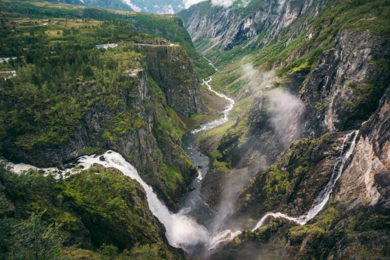
A panoramic view like no other
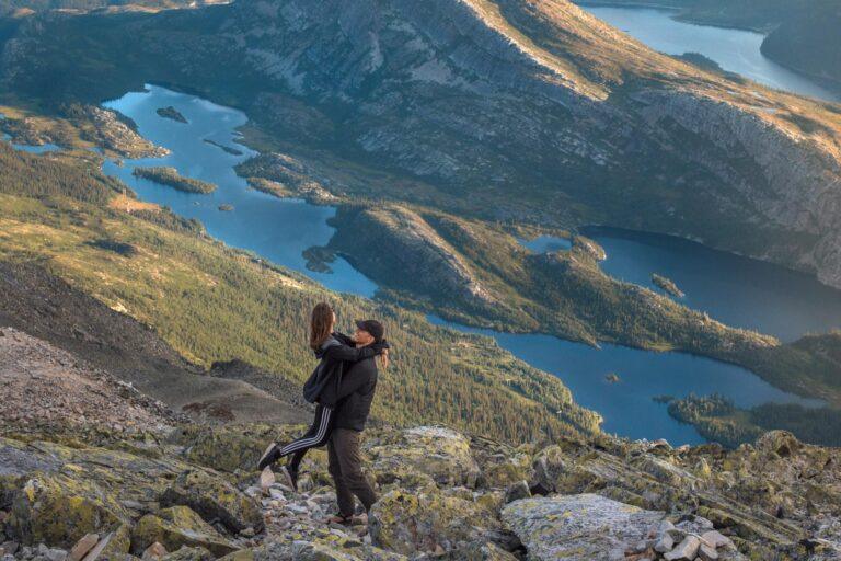
Although we haven’t seen too many panoramic views in Norway (yet), we believe it when it’s said that Gaustatoppen offers the greatest panoramic views of Norway.
It’s possible to see about one-sixth of mainland Norway on a clear day.
We were blown away by the sight of mountain peaks and pearly lakes all around us from the summit.
If you don’t want to hike Gaustatoppen, it’s also possible to reach the top with the funicular railway Gaustabanen in just 15 minutes, making the top accessible to all.
Where to stay near Gaustatoppen:
- Gaustablikk Fjellresort – A stylish 4-star mountain resort with excellent facilities, stunning views and the closest luxury stay to Gaustatoppen.
- Rjukan Hytteby – A cosy collection of self-catering cabins in central Rjukan, perfect for longer stays and travellers who want a little more space.
- Rjukan Hotell – A comfortable, centrally located hotel with an included breakfast and free parking, ideal for exploring both Rjukan and Gaustatoppen.
Search for the best hotels near Gaustatoppen here.
Table of contents


What to expect at Gaustatoppen
Gaustatoppen is Telemark’s highest mountain (at 1,883 metres above sea level), making it a natural tourist attraction in Southern Norway.
The mountain has lured happy hikers up its slopes for the past 200 years.
The hike to get to the summit isn’t too strenuous (if you choose the easy route or the funicular railway), and the views along the way and from the top are spectacular.
You’ll want to put on some sturdy shoes, though, as most of the “trail” is just different-sized hard rocks.
We saw plenty of children as well as dogs scaling Gaustatoppen. If you do bring a dog, you should always keep it on a lead, as there can be plenty of hikers on the trails and grazing animals in the mountains.
The hiking trails also seemed popular with runners perfecting their off-road skills.
In winter, it’s popular to ski down Gaustatoppen or simply to enjoy the amazing views on a clear day.
At the top, the tourist cabin serves simple dishes, coffee and a famous waffle with jam.


Travel inspiration and tips for planning your own adventure in Southern Norway.


Where is Gaustatoppen?
Gaustatoppen is located in the region of Telemark in southern Norway.
As the highest mountain in Telemark, it stands prominently above the surrounding landscape and is one of the country’s most recognisable peaks.
The mountain is located near the village of Rjukan, around a three-hour drive from Oslo.
Its distinctive shape and accessible hiking trails make Gaustatoppen a popular destination for both day hikers and outdoor enthusiasts.
How to get to Gaustatoppen
To get to the top of Gaustatoppen, you have several options.
There are four official hiking routes (Stavsro, Svineroi, Selstali and Rjukan) – as well as the funicular railway Gaustabanen if you aren’t too keen on walking all the way.
The hiking trails are marked with red T’s. With such an open landscape, it’s difficult to truly get lost (at least in clear weather).
In Norwegian terminology, the hikes are family-friendly for children who are used to hiking.
Below, we’ll cover how Gaustabanen works as well as hike difficulty and hike time on the four Gaustatoppen hikes.


Gaustabanen
In just 15 minutes, you can get to some of Norway’s best views with Gaustabanen, a funicular railway going up Gaustatoppen.
It first opened in 1959 as a secret NATO facility, and it didn’t open to tourists until 2010.
24 people can be transported at a time each way.
It departs every 15 minutes daily from 10:00 to 18:00. Opening times may vary with the seasons, so it’s a good idea to check beforehand on Gaustabanen’s website, where you can also see a live webcam feed.
For adults, the price is 430 NOK (~ 38 EUR / 44 USD)* for a single ride and 595 NOK (~ 53 EUR / 61 USD)* for a return ticket.
For children aged 5-15, the price is 200 NOK (~ 18 EUR / 20 USD)* for a single ride and 300 NOK (~ 27 EUR / 30 USD)* for a return ticket.
Children aged 0-4 and dogs ride for free.
It’s also possible to buy unlimited access to Gaustabanen for 24 or 48 hours.
Parking at Gaustabanen is free (if you buy a ticket).
*Prices are from 2026.

Hiking from Stavsro
Hiking from Stavsro is the easiest hiking route (and by far the most popular way) to get to the top of Gaustatoppen. It’s marked as being “challenging”, and we would categorise it as moderate.
Starting from the Stavsro car park, it’s about 4.9 kilometres each way with a vertical gain of about 700 metres. The Gaustatoppen hike from Stavsro starts at about 1,170 metres above sea level.
Most people should be able to hike it in 2-3 hours each way, and then you need to factor in time at the summit as well.
Some parts are almost flat while some are pretty steep. The terrain is very rocky.
Getting back down takes about the same amount of time as going up, as you have to really mind your step on the rocks.


Parking at Stavsro
Parking at Stavsro costs 150 NOK (~ 13 EUR / 15 USD)* for 24 hours.
The number of spaces is limited.
Arriving in high season in the middle of the day, we still easily found a spot for our car, though.
*The price is from 2026.

Hiking from Svineroi
The Svineroi route starts lower on the mountain and follows a steeper approach to the summit than the popular Stavsro trail.
Although the hike is shorter, it involves more elevation gain and requires a bit more stamina.
The trail is around 3 kilometres each way, with approximately 850 metres of elevation gain. Expect some steep sections as well as stretches of loose gravel underfoot.
Most hikers take around 2.5-3.5 hours one way.
After the initial climb, the Svineroi trail joins the Stavsro route roughly halfway to the summit.
If you’re planning to hike to Gaustatoppen one way and take the Gaustabanen the other, Svineroi is a convenient option.
The trailhead is only about 350 metres from the Gaustabanen car park.

Hiking from Selstali Seter
Hiking Gaustatoppen from Selstali Seter offers a different experience from the Stavsro and Svineroi routes, as you’ll approach the summit from the east instead of the west.
It’s also longer than the standard route and includes a sustained climb to the summit plateau.
The biggest difference is the scenery. You’ll begin in woodland before climbing above the treeline and into the open mountain landscape.
When you begin the Gaustatoppen hike from Selstali Seter, the hiking trail leads through Gausdalen past beautiful lakes before joining the southern route to the summit.
The hike is around 7.4 kilometres each way with around 950 metres of elevation gain. Most hikers take about 4-5.5 hours one way.
The trail is steep in places but otherwise straightforward to follow.
Parking is available at Selstali Seter. To get there, you’ll need to drive on a toll road, which costs 40 NOK (~ 3.6 EUR / 4 USD)*. You can pay in cash or by card at Selstali Seter.
*The price is from 2026.

Hiking from Rjukan
If you really want to earn your summit, consider starting your Gaustatoppen hike in Rjukan.
The route from Rjukan is the longest and most demanding way to hike Gaustatoppen, covering around 10 to 12 kilometres each way.
Beginning near the valley floor, it involves around 1,600 metres of elevation gain, making it a serious test of endurance.
Most hikers take 6-8 hours (one way!), so this route is best suited to anyone looking for a full-day mountain adventure.
Start at Rjukan railway station. Once you reach Lislestaul, you can either continue through the Gausdalen Valley (around 7 hours) or take the eastern route via Svineroi (around 8.5 hours).
As this is a very long hike, it’s worth considering either spending the night near the summit or taking the funicular railway back down.

Gaustatoppen hike difficulty: Which route should you choose?
If reaching the summit by the easiest hiking route is your priority, Stavsro is the clear choice.
We even saw dogs and children on the Stavsro trail. That said, Norwegians are known for introducing children to hiking from an early age, so we’d only recommend this hike for children who are used to being very active.
For a quieter and longer mountain experience, Selstali Seter and Svineroi offer good alternatives, while the Rjukan route provides the greatest challenge and the longest hike time of all the main approaches to Gaustatoppen.
See them compared here.
Stavsro route
This is the easiest and most straightforward route, making it the best choice for most visitors and first-time hikers.
- Distance: Around 4.9 kilometres each way
- Elevation gain: Approximately 700 metres
- Hike time: 2-3 hours each way
- Hike difficulty: Moderate
Svineroi route
This route suits experienced hikers looking for a longer day on the mountain without tackling the most demanding ascent.
- Distance: Around 3 kilometres each way
- Elevation gain: Approximately 850 metres
- Hike time: 2.5-3.5 hours each way
- Hike difficulty: Moderately challenging
Selstali route
For hikers comparing the different options, the Gaustatoppen hike difficulty from Selstali Seter sits somewhere between the Stavsro and Rjukan routes.
- Distance: Around 7.4 kilometres each way
- Elevation gain: Approximately 950 metres
- Hike time: 4-5.5 hours each way
- Hike difficulty: Moderately challenging
Rjukan route
This route is best suited to experienced hikers with good fitness levels and enough time for a long day on the trail.
- Distance: Around 10 to 12 kilometres each way
- Elevation gain: Approximately 1,600 metres
- Hike time: 6-8 hours each way
- Hike difficulty: Challenging

Facilities and practical information
Toilets on Gaustatoppen
Don’t expect luxury at the Stavsro car park. There’s a simple outhouse-style toilet before you set off, while toilets are also available at the summit for a small fee.
The facilities at the top have recently been upgraded and now include modern restrooms, a café and a comfortable lounge at the tourist cabin.
If you plan to use the toilets, it’s worth carrying a few coins just in case.
Water and food
There is no running water on Gaustatoppen, so don’t rely on refilling your water bottle at the summit.
All water has to be transported up the mountain by the Gaustabanen funicular, which is why it isn’t freely available.
You can buy water, hot drinks and food at the tourist cabin, but it’s best to carry enough water for your hike, especially on warm summer days.
Mobile signal
Mobile reception on Gaustatoppen is generally better than you might expect thanks to the mountain’s long history as a communications hub.
That said, don’t rely on your phone completely. Batteries drain quickly in cold weather, and poor visibility or the exposed terrain can still affect your signal.
Download your route in advance and treat any mobile coverage as a bonus rather than a guarantee.
Parking
The Stavsro car park is the main starting point for the most popular Gaustatoppen hike. In 2026, it costs 150 NOK (~ 13 EUR / 15 USD)* for 24 hours.
During weekends and throughout the summer holidays, however, it can fill up quickly, so arriving early is a good idea if you want to avoid the busiest times.
If you’re hiking one way and taking the Gaustabanen back down, you can either walk the short distance back to Stavsro or use the shuttle bus that runs between the mountain railway and the car park during the summer season.
Weather and what to wear
The weather on Gaustatoppen can change surprisingly quickly. It might be warm and sunny at the trailhead but cold, windy or foggy by the time you reach the summit.
Wear layers that you can easily add or remove, and always pack a waterproof jacket, even if the forecast looks promising.
Sturdy hiking boots or trail shoes with good grip are recommended, as the rocky terrain can become slippery when wet. We did it in sneakers, though, and it was fine.
Dogs
As mentioned, dogs are welcome on the Gaustatoppen hike and are a common sight on the trails.
Always keep your dog on a lead, as there are often other hikers and grazing animals in the mountains.
Remember to bring plenty of water for your dog too, especially on warm days, as there is no free drinking water available at the summit.
Safety tips
The trails to Gaustatoppen are well marked, but this is still a mountain hike.
Check the weather forecast before you set off and be prepared to turn back if conditions deteriorate. You can also see a live webcam from Gaustatoppen here.
Carry enough water and snacks for the day, and let someone know your plans if you’re hiking alone.

When to visit Gaustatoppen
Seasons
We hiked Gaustatoppen at the beginning of August at the height of the Norwegian summer (June, July and August).
With temperatures 5-10ºC lower than down in Rjukan, it was 10-15ºC on the summit (50-59ºF).
When the sun started setting, we were happy to have brought gloves, but we never felt cold on the hike.
If you dress appropriately and bring extra layers, your biggest worry is most likely cloud cover obscuring the views.
Even though it rained lightly in the morning, the weather cleared up and offered us perfect views from the summit.
During spring (March, April and May) as well as autumn (September, October and November), you have to plan for even more unpredictable weather, but climbing Gaustatoppen is still a great activity on clear days.
In winter (December, January and February), snow is usually prevalent and skiing down the slopes is popular. You can read more about skiing Gaustatoppen here (in Norwegian).
Access to Gaustatoppen is open 24/7 all year round. Some roads may close in winter.

Time of day
In summer, it seems like visiting Gaustatoppen in the morning might give you better chances of cloud-free views.
Sunset is, of course, also a great time to visit the peak as the last colours of the day fade away into the distance.

Where to stay near Gaustatoppen
If you’re looking for a place to stay near Gaustatoppen, you’ll find several accommodation options depending on your budget and travel style.
There isn’t a huge selection, though, so it’s worth booking ahead if you have a particular place in mind.
For a unique experience, it’s even possible to spend the night at the summit. During the summer season, the tourist cabin, Gaustatoppen Turisthytte, has space for 11 overnight guests.
As places are limited, booking in advance is highly recommended. You can read more about it and book a spot on the official website.
We also saw a few people sleeping outside in sleeping bags, although we’re not sure whether overnight camping on the summit is permitted.
As we were travelling by campervan, we stayed at Rjukan Hytte- og Caravanpark 8 kilometres east of Rjukan.
If camping isn’t your style, we’ve included our recommendations for hotels near Gaustatoppen below.
Search for the best hotels near Gaustatoppen here (adlink).

Rjukan Hytteby
Rjukan Hytteby isn’t a traditional hotel but a collection of cosy cabins inspired by the colourful workers’ houses that helped make Rjukan famous.
It’s a great option if you’re looking for a little more space and independence than a standard hotel room.
The cabins are located in a quiet part of central Rjukan, within easy walking distance of restaurants, cafés and shops, making them a convenient base for exploring both the town and nearby Gaustatoppen.
Accommodation ranges from compact cabins for couples to larger family cabins and apartments.
Depending on the cabin you choose, you’ll have a private bathroom, comfortable living area and either a kitchenette or a fully equipped kitchen. Free wifi and parking are also included.
We think Rjukan Hytteby is particularly well suited to travellers staying for a couple of nights or longer, especially if you plan to combine a hike up Gaustatoppen with sightseeing around Rjukan and the surrounding mountains.
Check prices and availability at Rjukan Hytteby (adlink).


Rjukan Hotell
If you prefer the convenience of a traditional hotel, Rjukan Hotell is a great choice.
Located in the heart of Rjukan, it’s within easy walking distance of everything you might need, while also making a convenient base for hiking Gaustatoppen.
The hotel has recently been renovated while retaining its long history, which dates back to 1910.
Today, it offers comfortable double and family rooms with private bathrooms, free wifi and an included breakfast.
One of the highlights is the on-site D2O Restaurant & Bar, serving breakfast, lunch and dinner, so you won’t have to head back into town after a long day on the trails.
Free parking is also available, making it easy to drive to the Gaustatoppen trailheads the following morning.
Check prices and availability at Rjukan Hotell (adlink).

Gaustablikk Fjellresort
If you’re looking for the nicest place to stay near Gaustatoppen, Gaustablikk Fjellresort is your best bet.
This modern 4-star mountain hotel sits at the foot of the mountain overlooking Gaustatoppen and Kvitåvatn, just a short drive from the Stavsro trailhead.
The hotel combines stylish rooms with excellent facilities, including several restaurants and bars, a generous breakfast buffet, a wellness area with a swimming pool and saunas, and cosy lounges with fireplaces and mountain views.
It’s the perfect place to relax after a long day on the trails.
Rooms range from comfortable doubles to spacious family rooms and suites, while free parking and wifi are included.
If you’re visiting in winter, the hotel also offers ski-in, ski-out access to Gausta Ski Centre.
Although it’s the most expensive accommodation in the area (though still affordable!), the location, facilities and spectacular views make it well worth considering if you’re after a memorable mountain stay rather than simply a place to sleep.
Check prices and availability at Gaustablikk Fjellresort (adlink).


What to bring to Gaustatoppen
- Sunscreen (adlink). Though the weather can feel cold, the sun is strong at altitude.
- Hiking shoes. Wearing sturdy boots or similar will help a lot with tackling all the stones.
- Change of clothes. Bring layers and accessories like gloves and a hat. It can be a lot colder on the top than down by the parking lots.
- Plenty of snacks and water. Norway’s water tastes so good.
- Map and compass. The cold weather will drain your phone’s battery quicker than you expect it to. Knowing in which direction to head is super valuable when the clouds suddenly roll in.
- A good camera – here’s a guide to the gear we use.
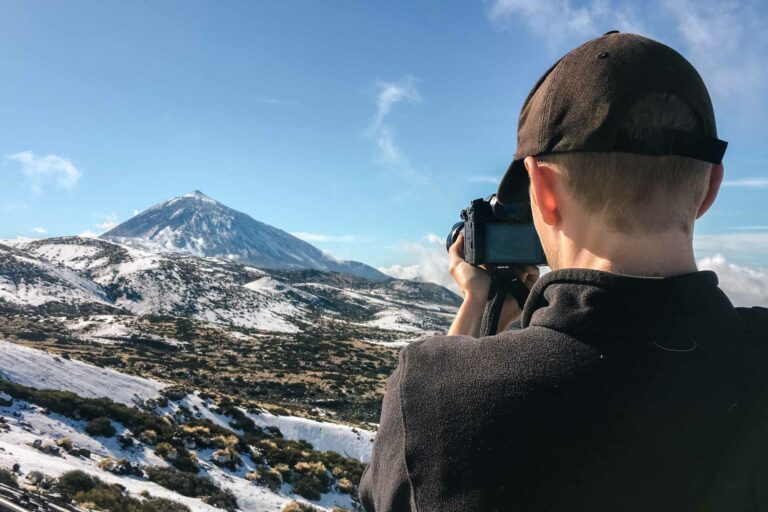
What camera, drone and accessories we use to capture life on the road

The Norwegian Mountain Code
- Plan your trip and inform others about the route you have selected.
- Adapt the planned routes according to ability and conditions.
- Pay attention to the weather and avalanche warnings.
- Be prepared for bad weather and frost, even on short trips.
- Bring the necessary equipment so you can help yourself and others.
- Choose safe routes. Recognise avalanche terrain and unsafe ice.
- Use a map and a compass. Always know where you are.
- Don’t be ashamed to turn around.
- Conserve your energy and seek shelter if necessary.
Source: Dnt.no

Sustainable travel tips
Having just returned from a long trip to Asia where we encountered rubbish on almost every hike, we were pleasantly surprised to see absolutely no trash on Gaustatoppen.
Let’s keep it that way!
To minimise your impact on Gaustatoppen, follow these guidelines:
- Bring everything back down. What goes up must come down. There’s no trash can up there, so bring back all your trash.
- Take only photos, leave only footprints. Let the rocks stay on the mountain.
- Be considerate of other visitors. Enjoy the views in silence.
- Respect wildlife. Don’t chase the cute sheep who live on Gaustatoppen.

Thanks for reading our guide to hiking Gaustatoppen
Thanks for reading our hiking guide to Gaustatoppen in Norway. We hope it has been useful!
What do you think about Telemark’s highest peak?
If you’ve been to Southern Norway, it would be awesome to hear your best tips in the comments. If you haven’t been yet but would like to, please don’t hesitate to ask away.


Our favourite travel resources:
- Booking.com for hotels and apartments.
- Momondo for the best flight deals.
- AirHelp for flight delay compensation.
- GetYourGuide for great tours everywhere.
- Airalo for reliable eSIM.
- Discover Cars for transparent car hire.
- SafetyWing for travel insurance. We also like True Traveller. Compared here.

Vøringsfossen Waterfall in Norway: All You Need To Know
What to expect from visiting Norway’s most famous waterfall
-
Norway Caravan Itinerary: 2 Week South Norway Road Trip
Travel inspiration and tips for planning your own adventure in Southern Norway.
-
Eriba Touring Troll 530 Rockabilly Camper Review
Travelling South Norway with the retro charm of the 50's including modern amenities