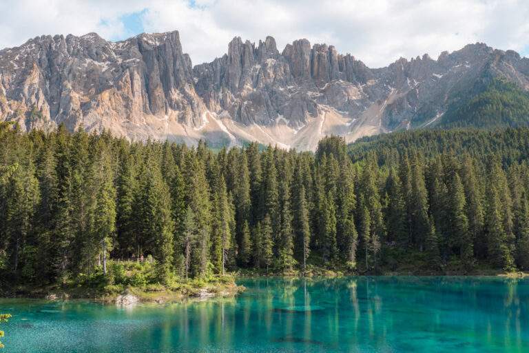
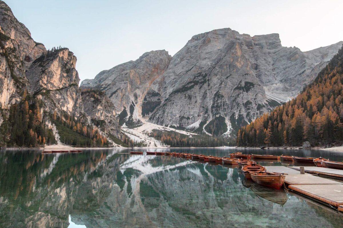
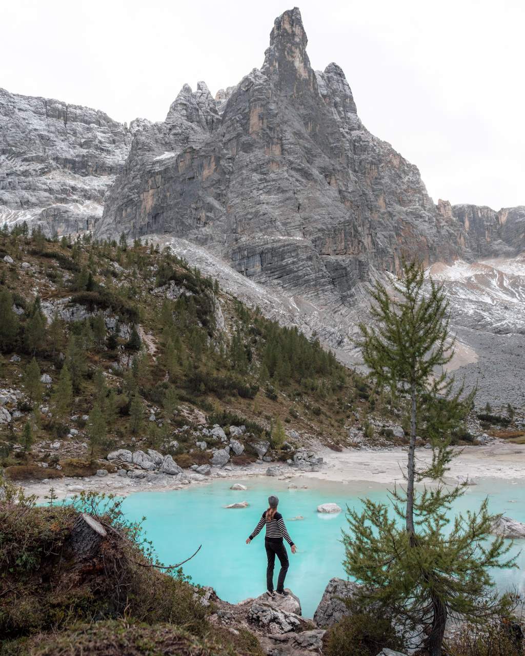
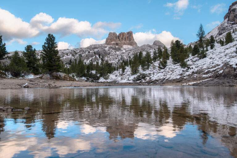
The bluest lake you’ll ever hike to
We won’t be forgetting the view over Lago di Sorapis any time soon.
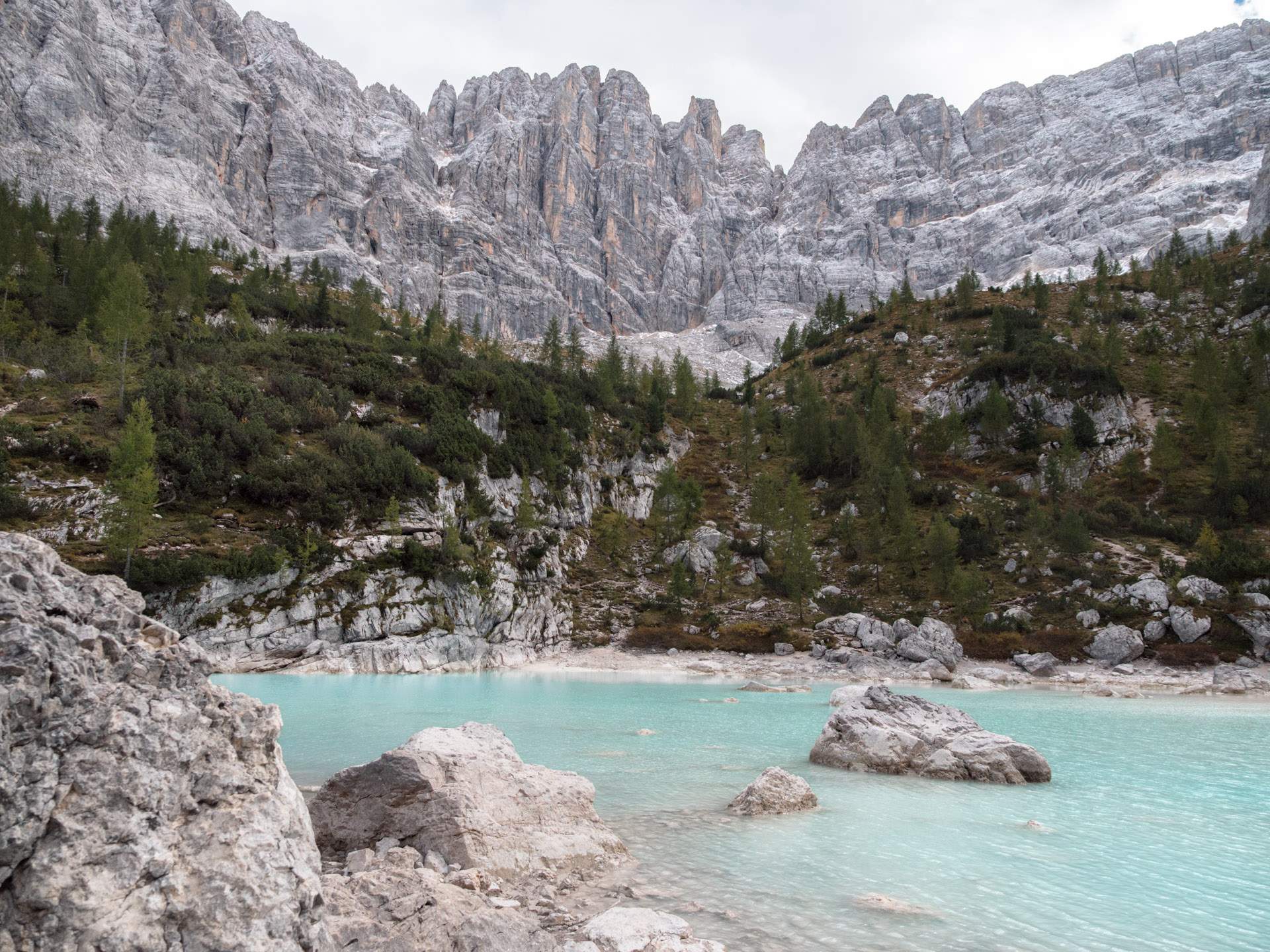
With its turquoise water and jagged peaks all around, it’s one of the most beautiful mountain lakes in Italy.
Lago di Sorapis isn’t as well known as some of the other lakes in the Dolomites.
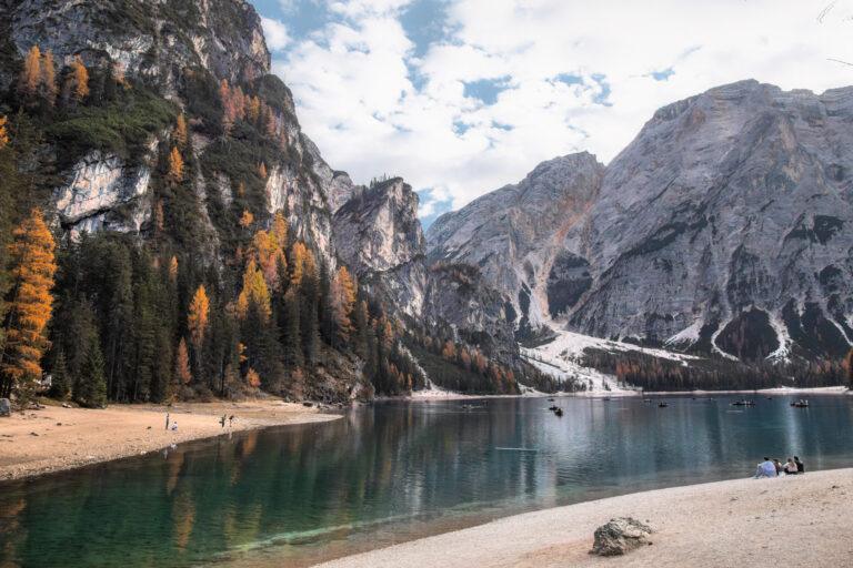
Both Lago di Braies and Lago di Carezza are stunning and can be reached with just a short walk from the car park to the viewpoint.
But that’s not the case with Lago di Sorapis.
The lake is tucked away high up in the Dolomites and takes a proper hike of about two hours to reach. That also means it’s far less crowded.
The trail is steep and rocky in places, and it takes a bit of effort to get there, but the reward is more than worth it!
Framed by dramatic mountain peaks, this turquoise glacial lake is an ideal destination for a scenic lunch spot or snapping great photos.
In this travel guide to Lago di Sorapis, we cover why it’s worth the hike, how to get there, practical info on parking and access, when to visit the lake and our best tips for making the most of the experience.
Where to stay near Lago di Sorapis
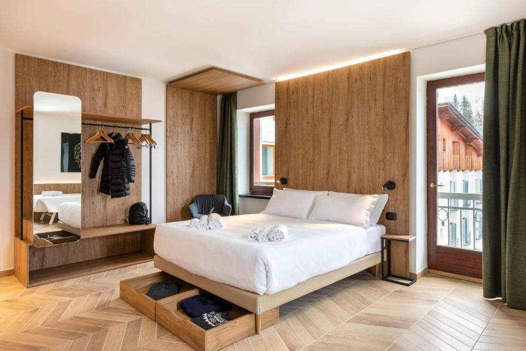
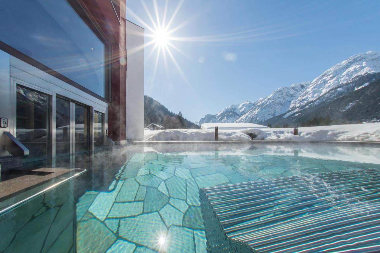
- Budget: B&B Hotel Passo Tre Croci Cortina – A great-value stay right where the hike to Lago di Sorapis begins.
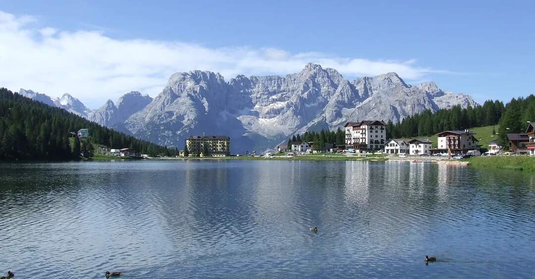
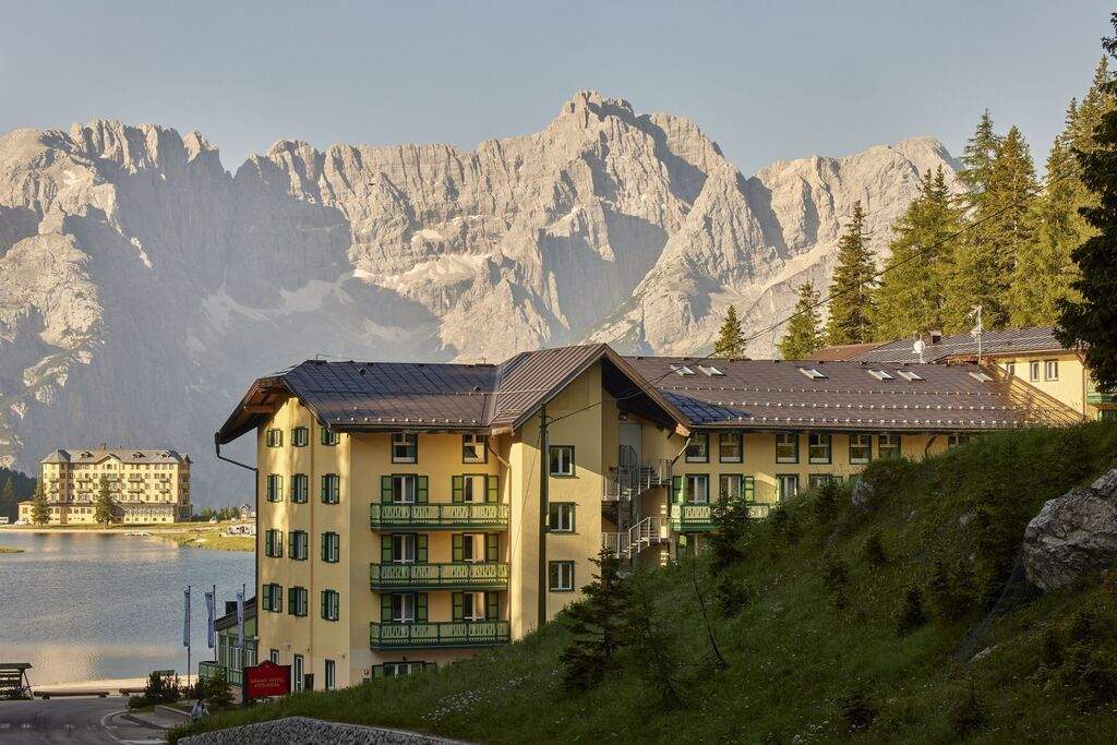
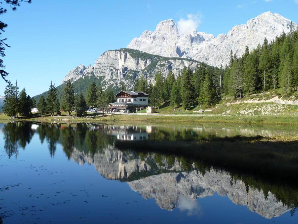
- Value for money: Hotel Sorapiss – 3-star hotel by Lago di Misurina, close to both Lago di Sorapis and Tre Cime.
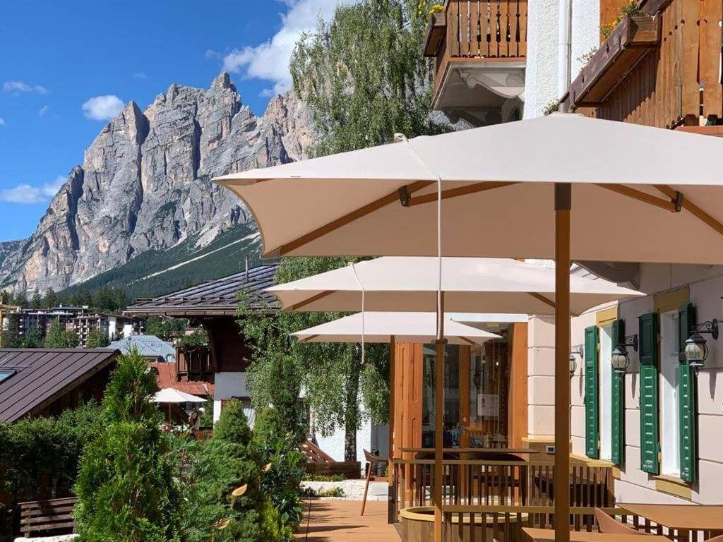
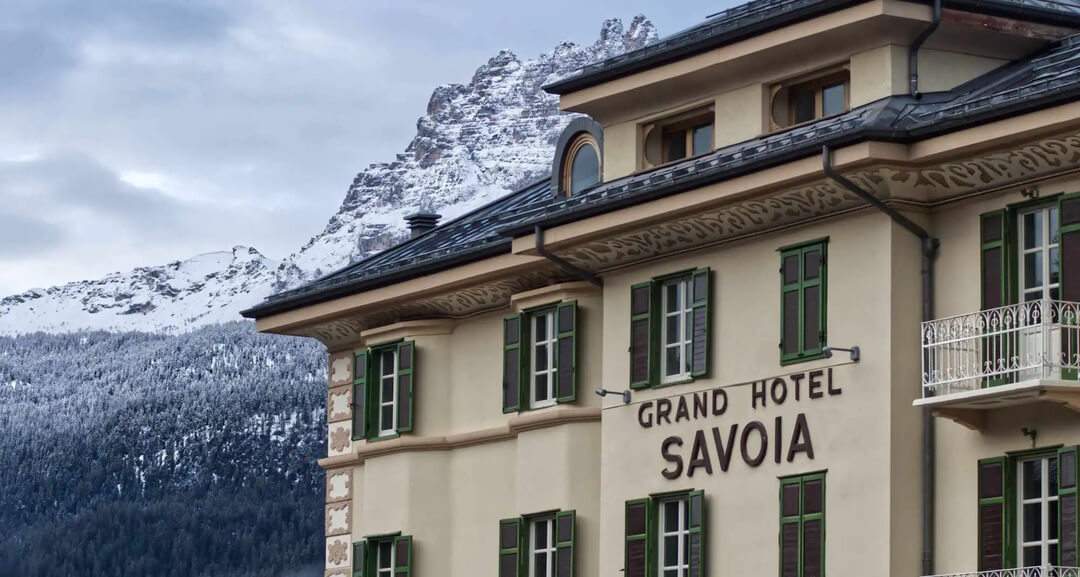
- Luxury: Grand Hotel Savoia Cortina d’Ampezzo, A Radisson Collection Hotel – One of the most spectacular 5-star hotels in Cortina d’Ampezzo, approximately 15 minutes away.
Search for the best hotels in Cortina d’Ampezzo here or read our comprehensive guide to where to stay in the Dolomites.
Table of contents
- What is Lago di Sorapis?
- Why visit Lago di Sorapis
- Overview of the Lago di Sorapis hike
- Lago di Sorapis hiking route
- Our experience at Lago di Sorapis
- Practical information about Lago di Sorapis
- How to get to Lago di Sorapis
- When to visit Lago di Sorapis
- How long to spend at Lago di Sorapis
- Where to stay near Lago di Sorapis
- Our best tips for Lago di Sorapis
What is Lago di Sorapis?
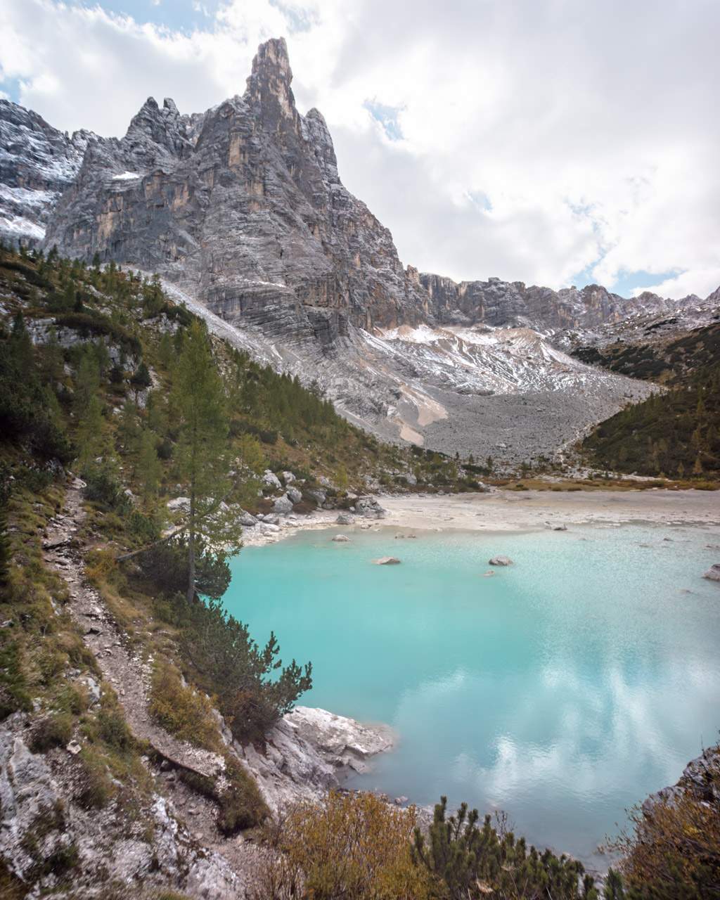
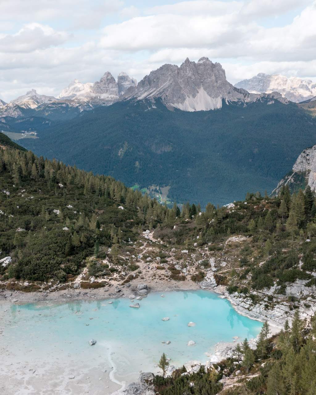
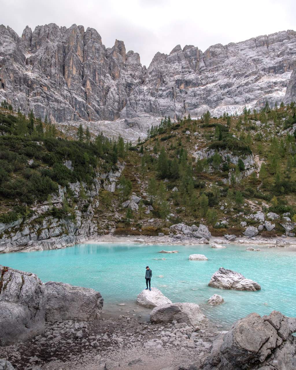
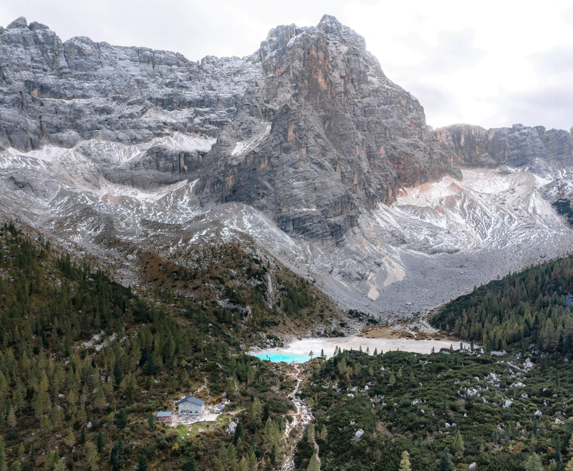
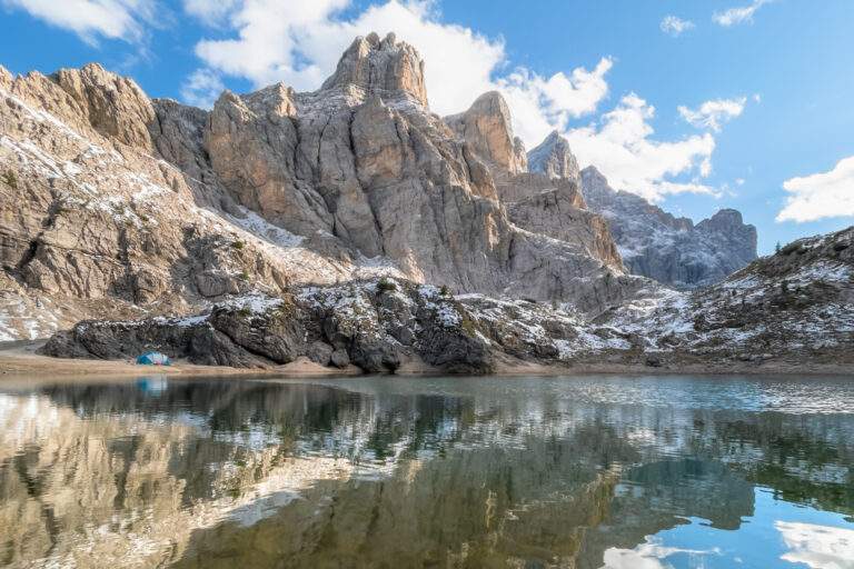
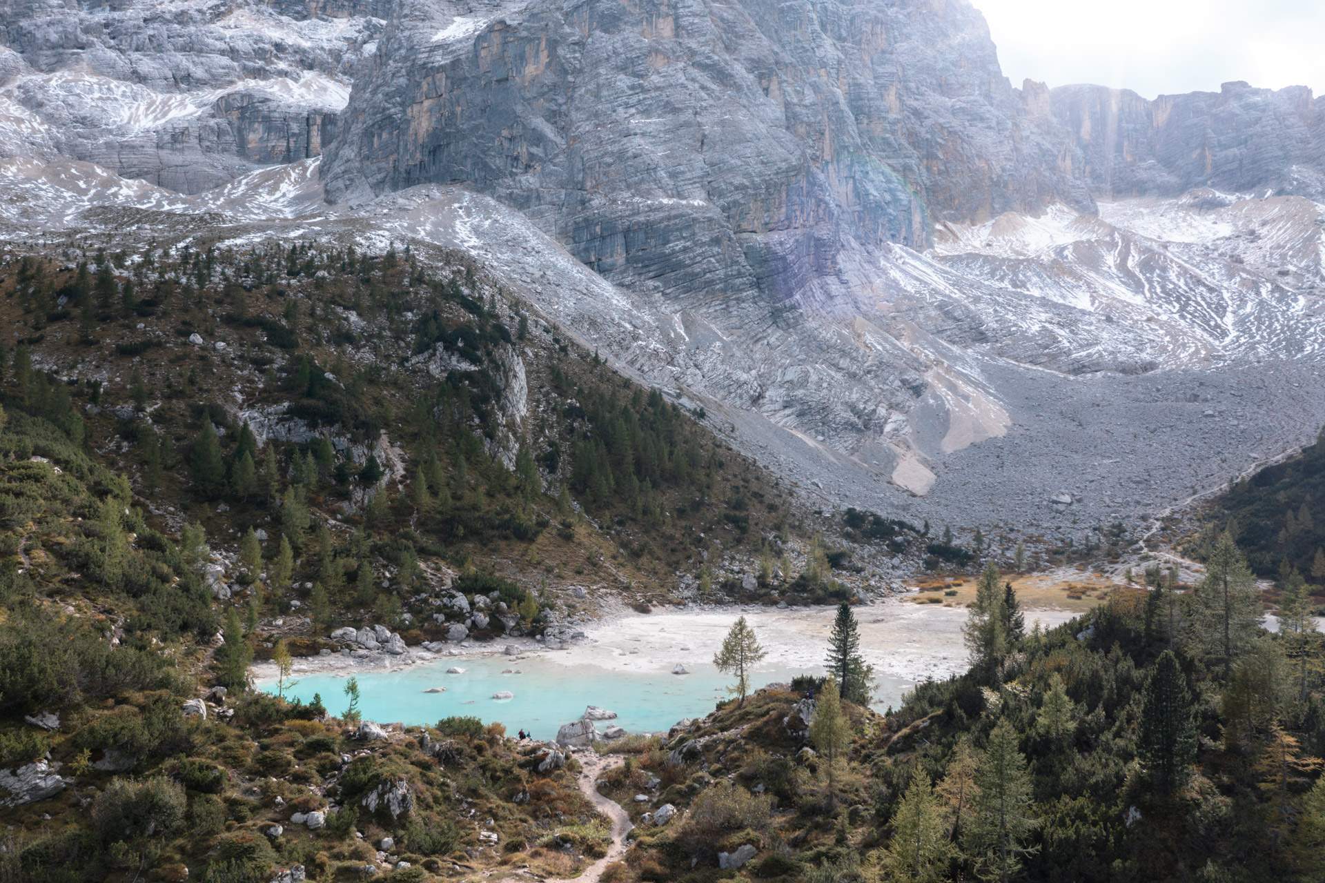
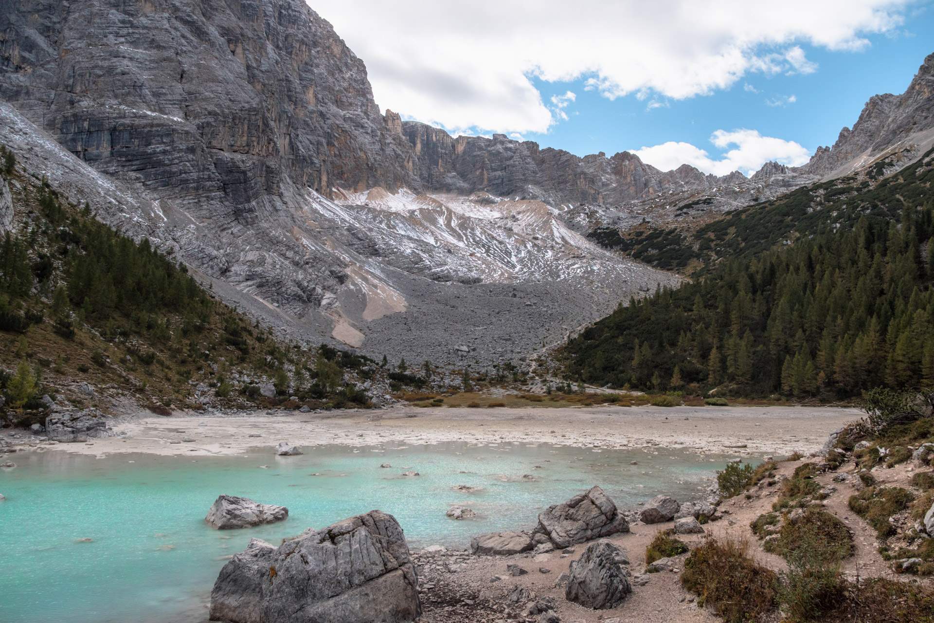
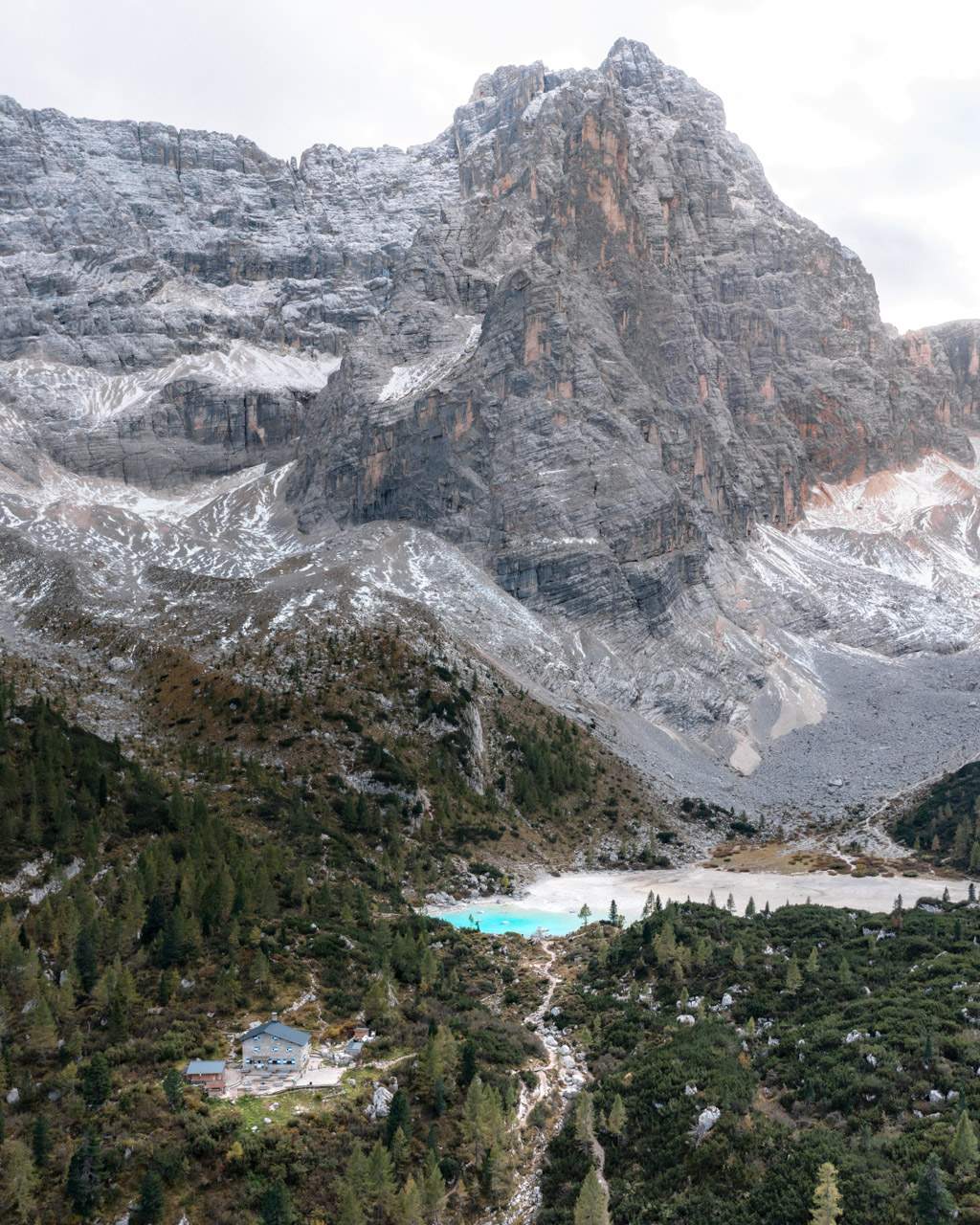
Lago di Sorapis is one of the Dolomites’ most spectacular mountain lakes, located at the foot of Punta Sorapis (3,200 metres/10,500 feet).
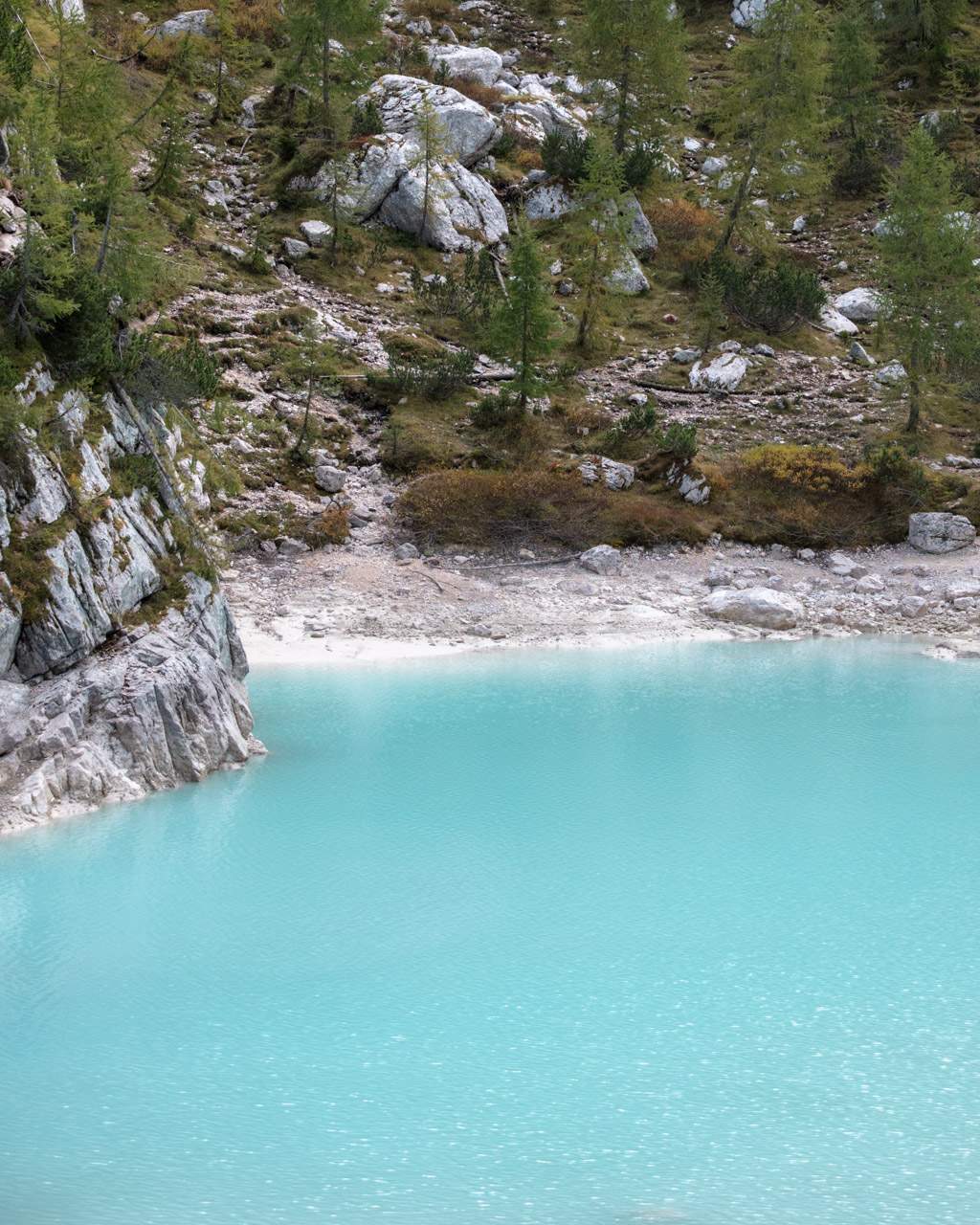
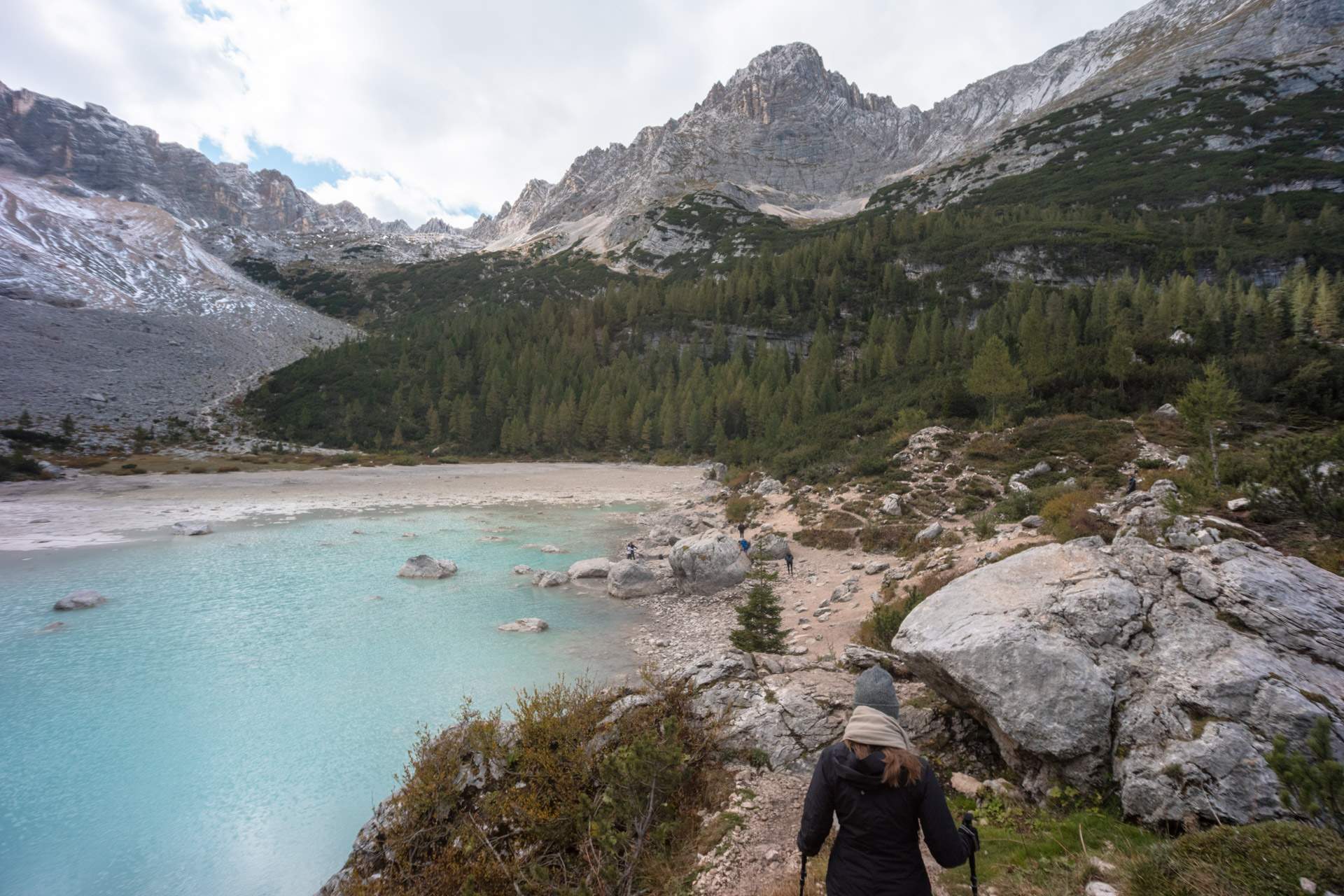
It’s known for its unusually clear, turquoise colour which is the result of fine silt from the surrounding peaks suspended in the glacial meltwater that feeds the lake.
Sitting at around 1,925 metres above sea level (~ 6,315 feet) and framed by steep, forested cliffs, the lake is both stunning and incredibly photogenic.
There are no roads leading directly to it, so you’ll need to hike along a marked Lago di Sorapis trail. Most people start from Passo Tre Croci (and so did we).
The hike does take a bit of effort and is more demanding than the walk to many of the Dolomites’ other well-known lakes.
Lago di Sorapis is also part of the famous Alta Via delle Dolomiti No. 3 – one of the classic high routes in the Dolomites. The route stretches from Villabassa (Niederdorf) in the north to Longarone in the south.
Map of Lago di Sorapis
Lago di Sorapis (Sorapissee in German) is located in the eastern part of the Dolomites, in the region Veneto in Italy.
The closest major town is Cortina d’Ampezzo, which is a popular base for exploring the Dolomites.
A travel guide to our favourite hikes in the Dolomites – from short walks to full-day adventures
Read moreWhy visit Lago di Sorapis
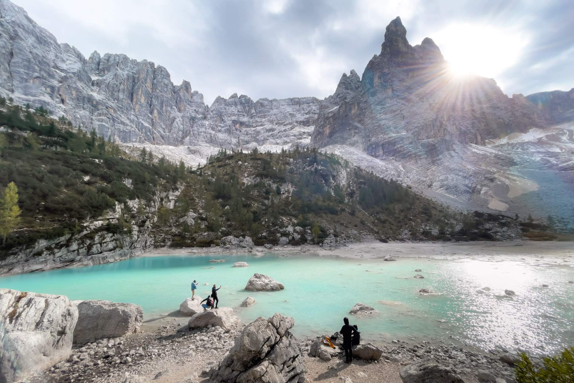
What makes Lago di Sorapis one of the Dolomites’ most unforgettable natural experiences is, of course, the almost unreal turquoise colour. And it’s entirely natural.
The fact that it’s surrounded by steep, dramatic mountains only adds to the magic.
Although Lago di Sorapis has gained popularity in recent years (thanks in part to Instagram), it still sees far fewer visitors than better-known spots like Lago di Braies and Lago di Carezza.
You can’t simply drive right up to the lake as you can with those two. The only way to reach it is on foot, with a hike that takes around two hours each way.
Lago di Sorapis isn’t exactly a hidden gem, and it’s definitely a well-known destination in the Dolomites, but the limited access means fewer crowds, which makes for a quieter, more authentic experience.
It’s one of the most beautiful hikes we’ve done in the Dolomites, and we’d highly recommend it to anyone with the time (and the legs!) to make the trek.
All you need to know about Lago di Carezza – parking, walking routes and our best tips
Read moreOverview of the Lago di Sorapis hike
- Start and finish: The hiking route begins here. If there’s no space to park on the roadside, you can leave your car just over 500 metres (~ 0.31 miles) away at this parking lot at Passo Tre Croci and start the hike from there.
- Duration: 5-7 hours, depending on how many breaks you take, photo stops, your walking pace and any detours.
- Distance: The return trip is roughly 12 kilometres. Any detours add to this.
- Elevation: ~ 460 metres uphill and downhill (~ 1,510 feet).
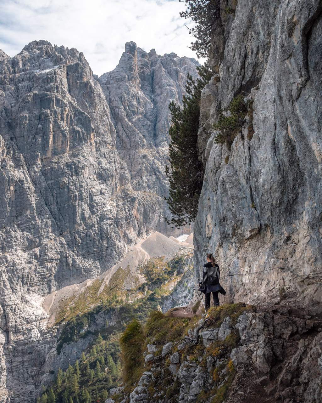
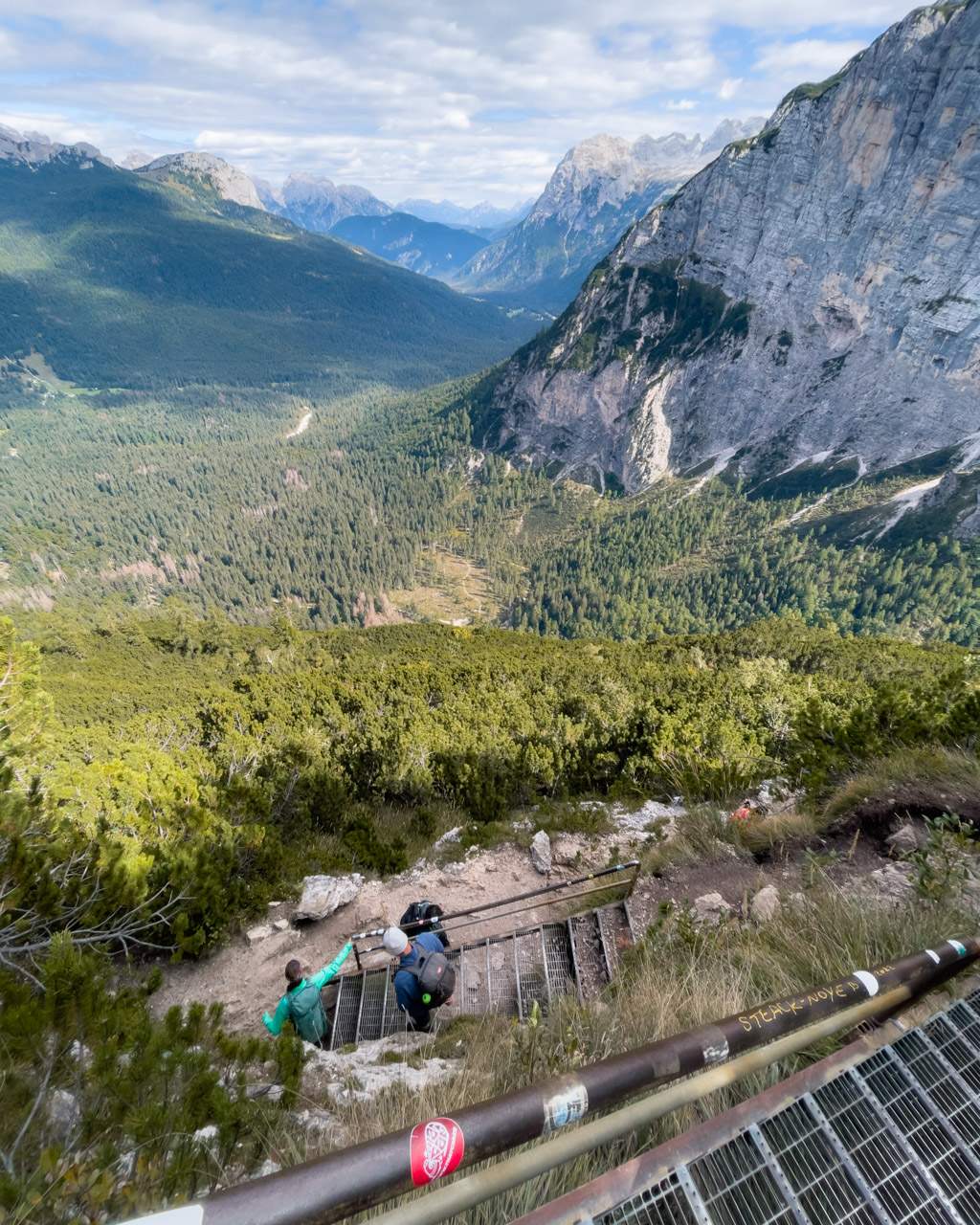
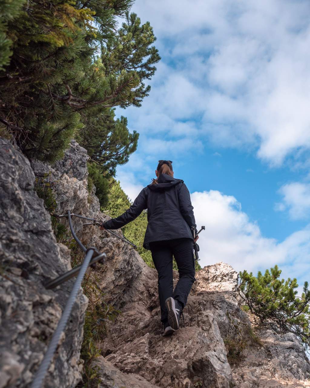
- Difficulty: Moderate. While the route doesn’t require technical climbing, it can be steep, rocky and rough in places. There are narrow, exposed sections along cliff edges (with ropes for safety), which might be challenging for anyone afraid of heights.
- Suitable for children and dogs: Families with older children used to hiking will likely manage this route. We wouldn’t recommend it for younger children. Dogs are welcome but must be kept on a lead.
- Trail surface: The path varies from wide, light gravel to narrower, steeper sections. In some spots you’ll need to climb over rocks, use metal stairs or hold onto ropes bolted to the rock. We found walking poles helpful for support, and recommend bringing them if you have some.
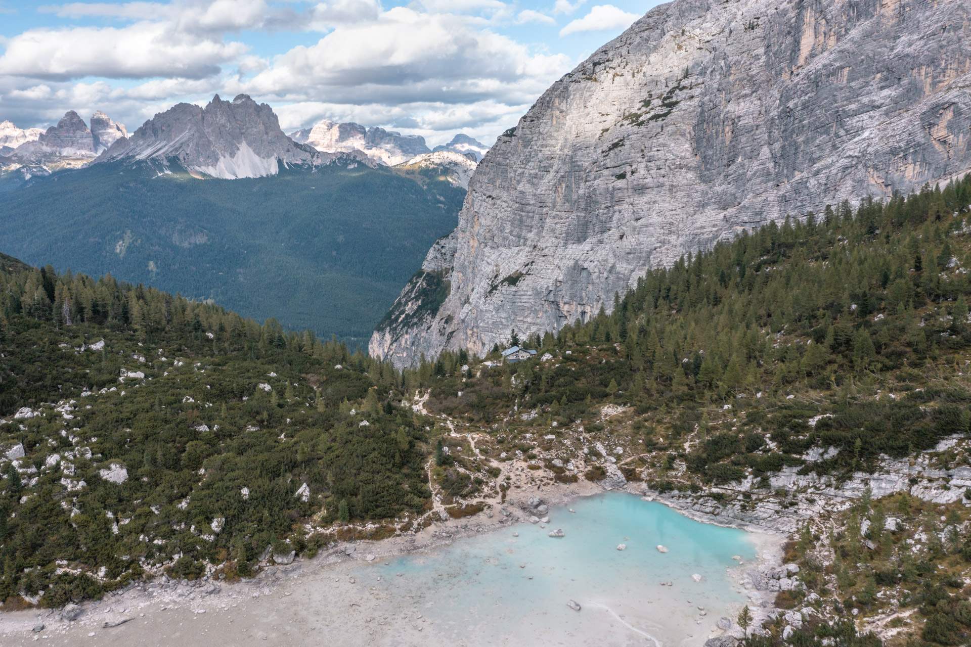
- Facilities: Rifugio Vandelli is just a few minutes from the lake, where you can buy food and use the toilets. There are no other facilities along the trail. The refuge is open only during the high season from late June to late September.
- Cost: Free!
Lago di Sorapis hiking route
The hiking route to Lago di Sorapis is generally easy to follow.
The most popular and straightforward way there (and back) is along route 215 towards Rifugio Vandelli.
If you’re experienced in the mountains and fancy a tougher challenge with steeper, rockier terrain, you can create a loop by combining routes 215, 216 and 213. We’ll cover that option a bit later in this travel guide to Lago di Sorapis.
Route 215 – main route to Lago di Sorapis
The hike starts at the “Lago di Sorapis Hike Trailhead” marked on Google Maps (1,805 metres/5,922 feet above sea level).
Here you’ll find a sign with a map, route suggestions and practical information.
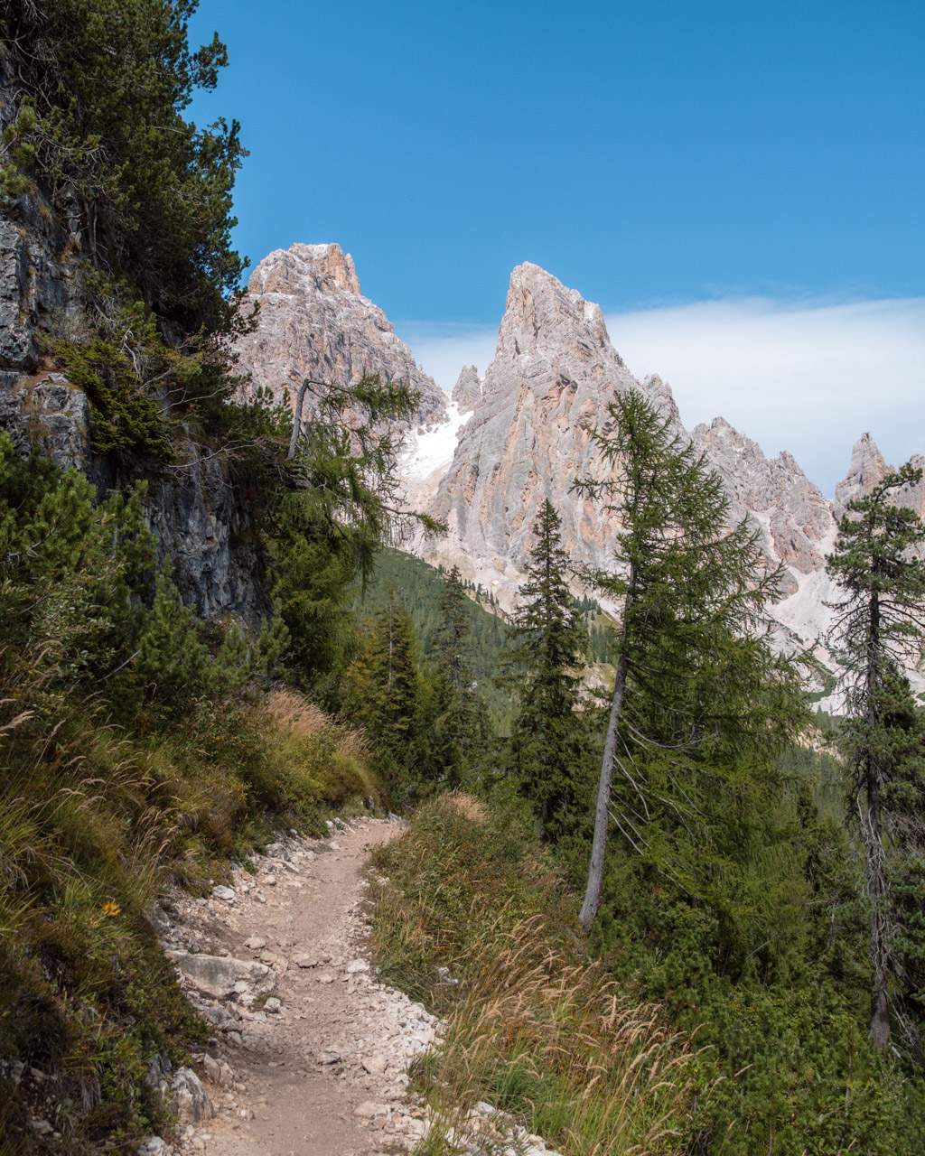
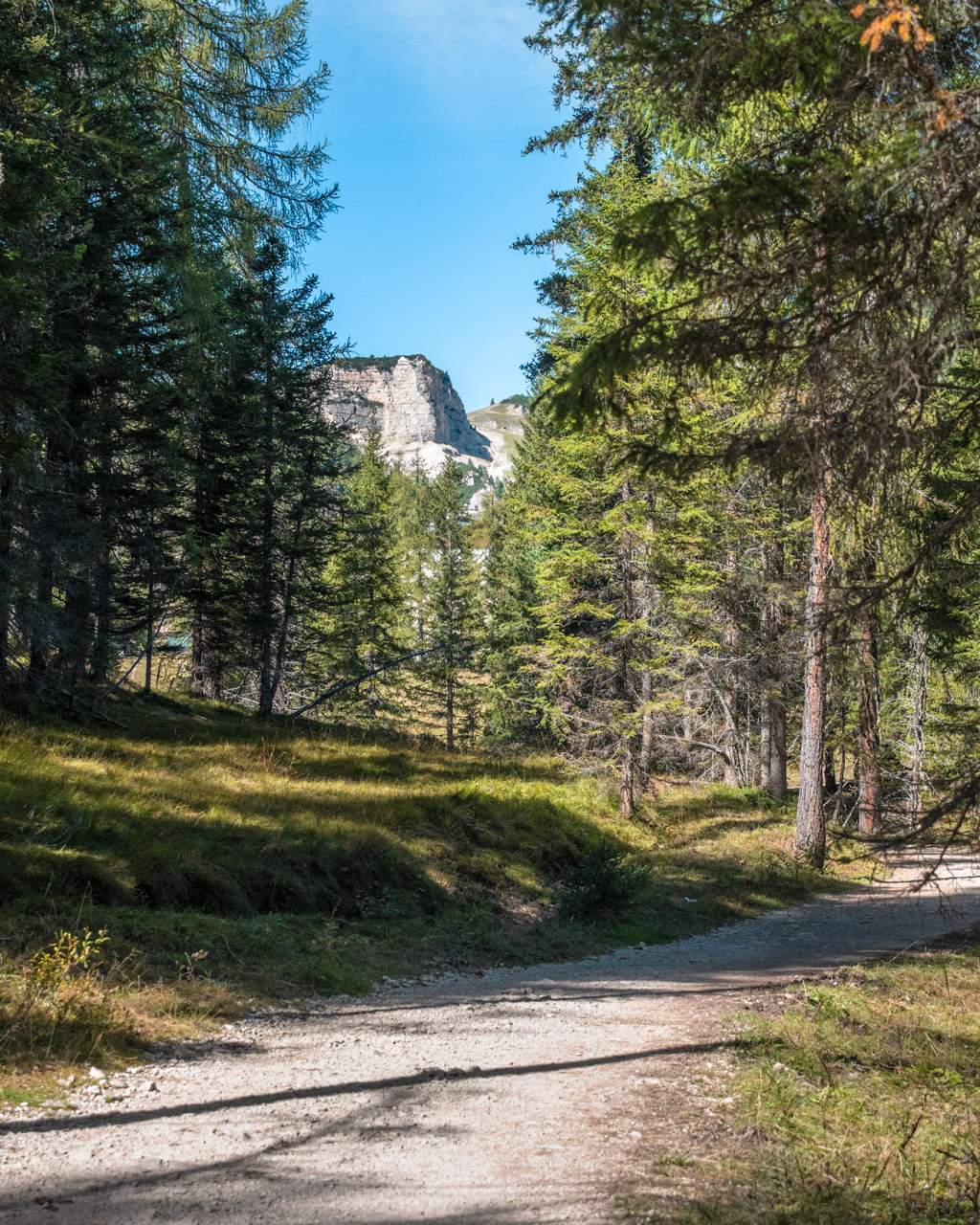
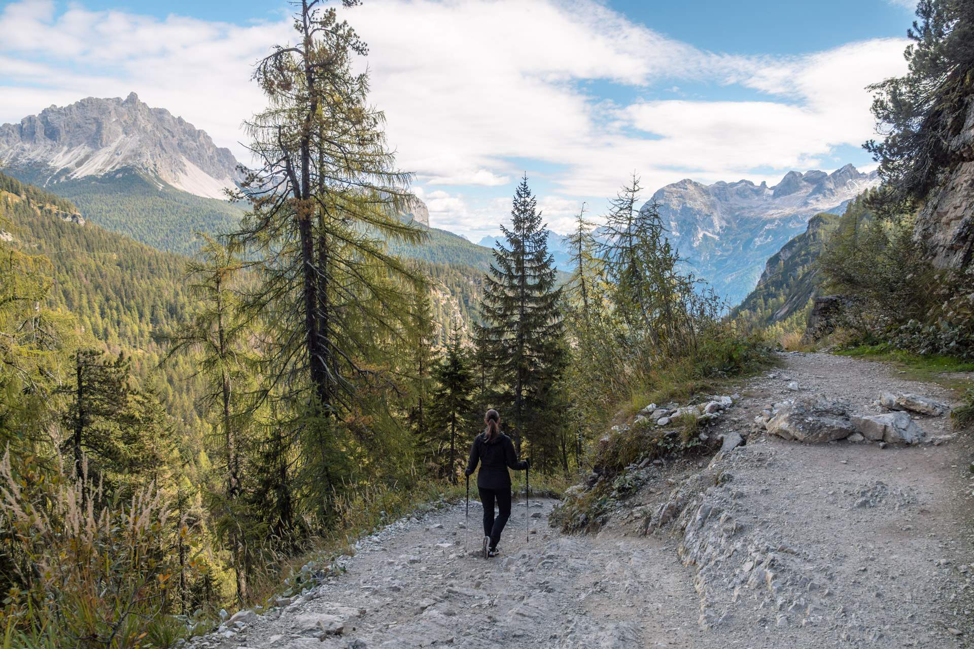
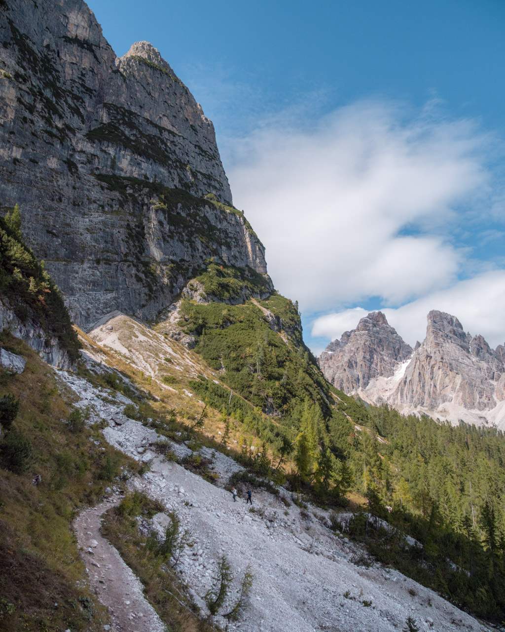
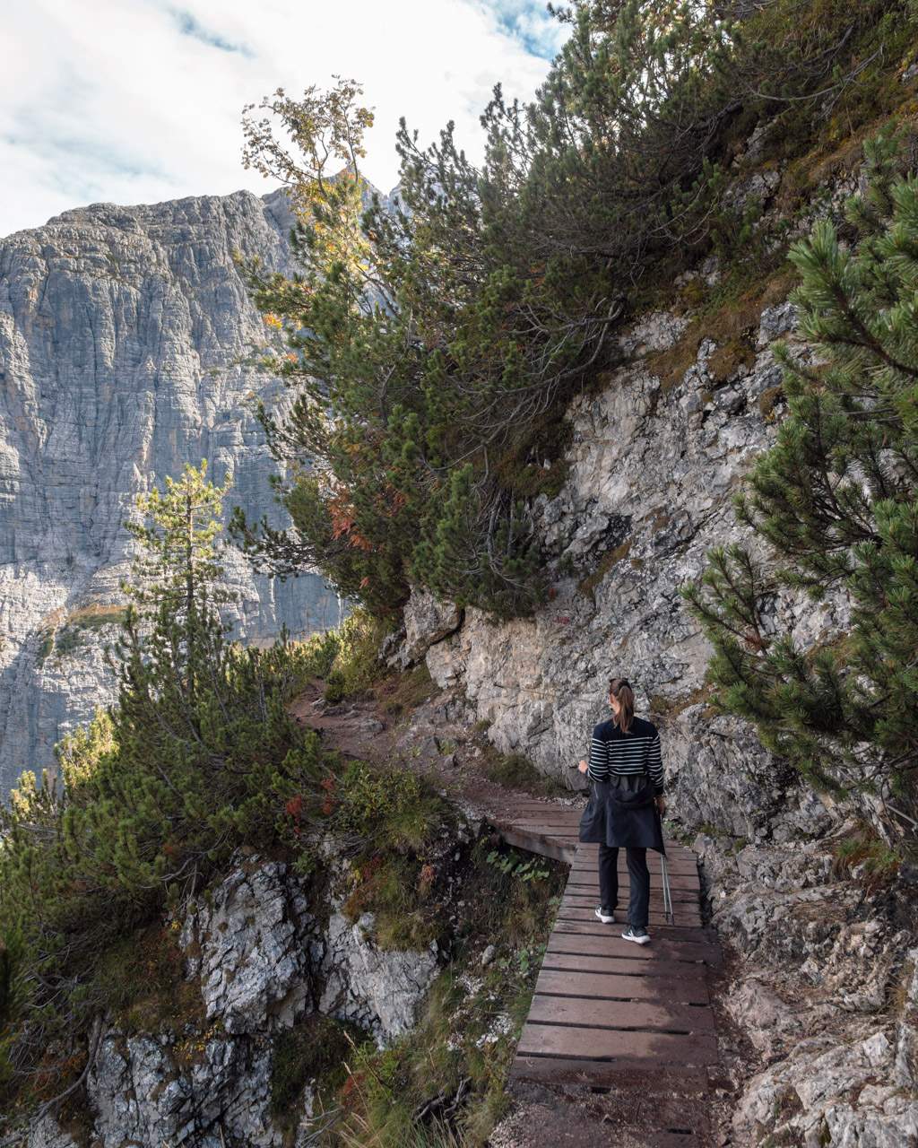
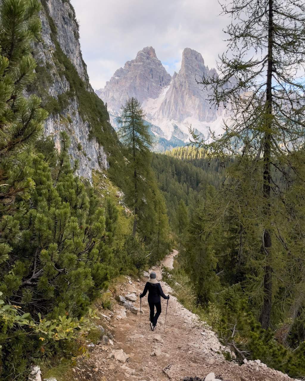
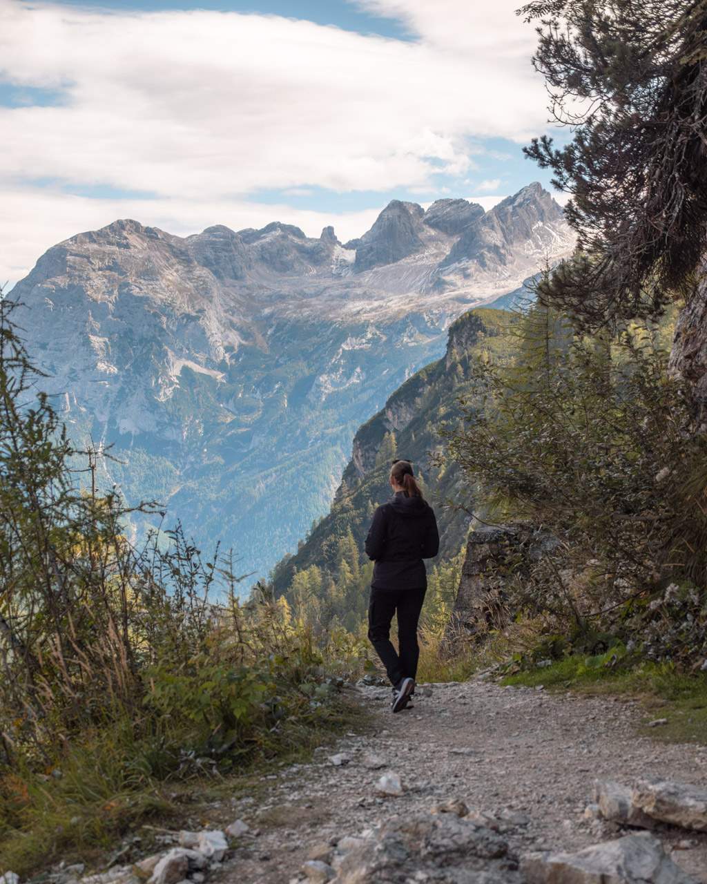
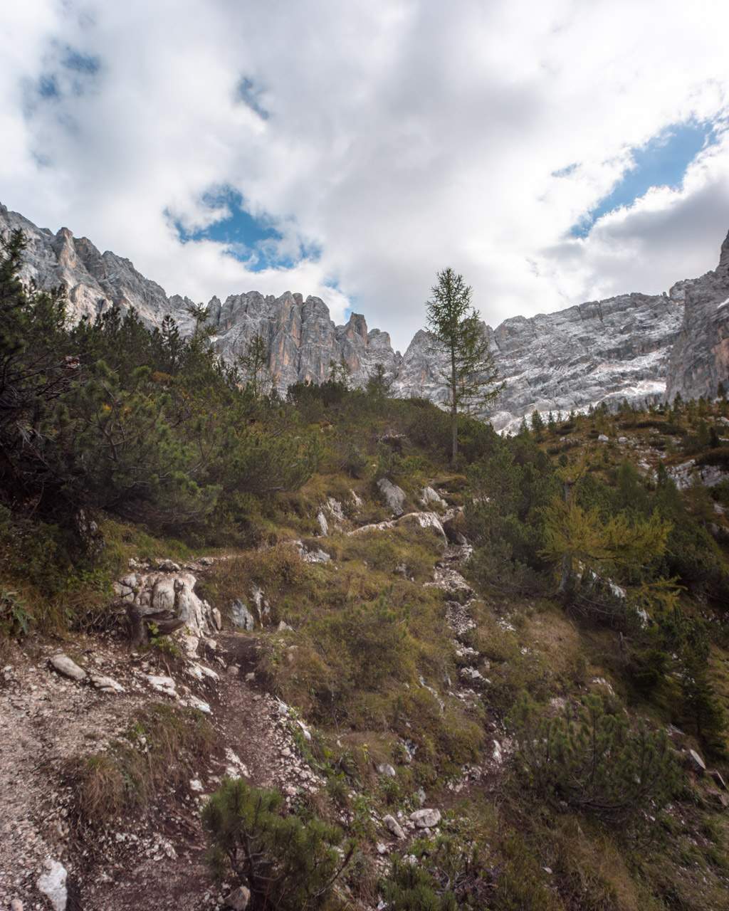
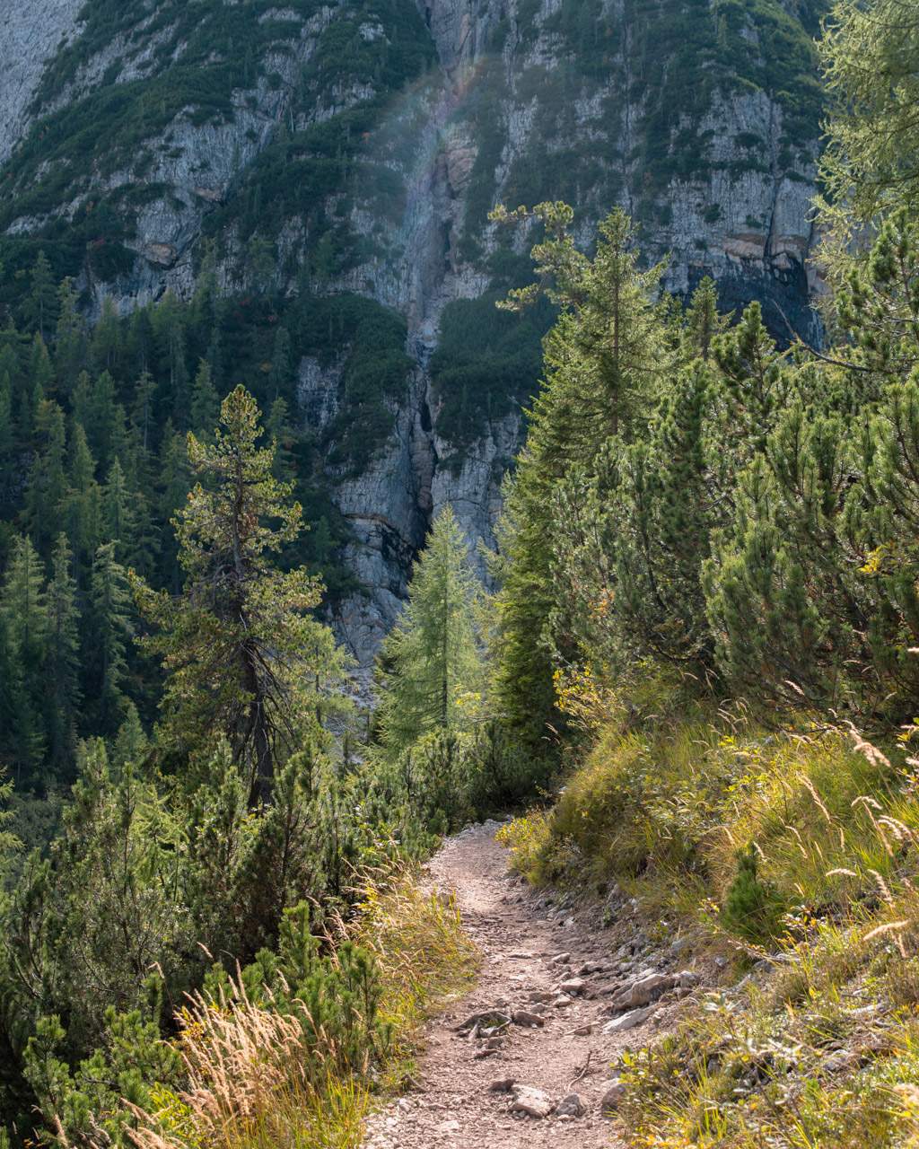
The hike begins gently along a wide dirt road, crossing a meadow before entering a cosy pine forest. After a few kilometres, the trail narrows, with some short steep sections and stunning views along the way.
At one point, the path splits: take the left fork to reach Lago di Sorapis.
As you approach the lake, the trail splits again. To the left is Rifugio Vandelli, where you can grab lunch and use the toilet. The path to the right leads down to the lake itself.
From there, the trail climbs briefly before descending to the shore – and from this point you’ll be treated to one of the most beautiful views of Lago di Sorapis.
Challenges along the hiking route
The surface on route 215 varies quite a bit. Some sections are rocky, others covered in loose gravel, and you’ll even find metal stairs in places.
In certain spots, ropes are bolted to the rock face to help with grip along the more exposed sections.
If you’re afraid of heights, some parts might feel a little unsettling, though we didn’t find them directly dangerous.
In total, the hike involves about 460 metres of ascent and descent (~ 1,510 feet). It might not sound like much, but some parts are quite steep.
You’ll usually come across plenty of other hikers, so it’s important to be careful and considerate when passing each other on the narrowest, most exposed stretches.
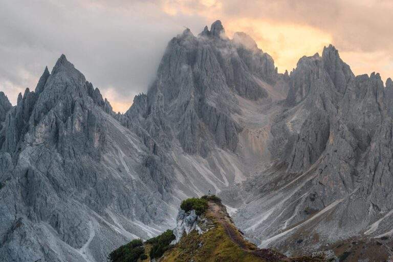
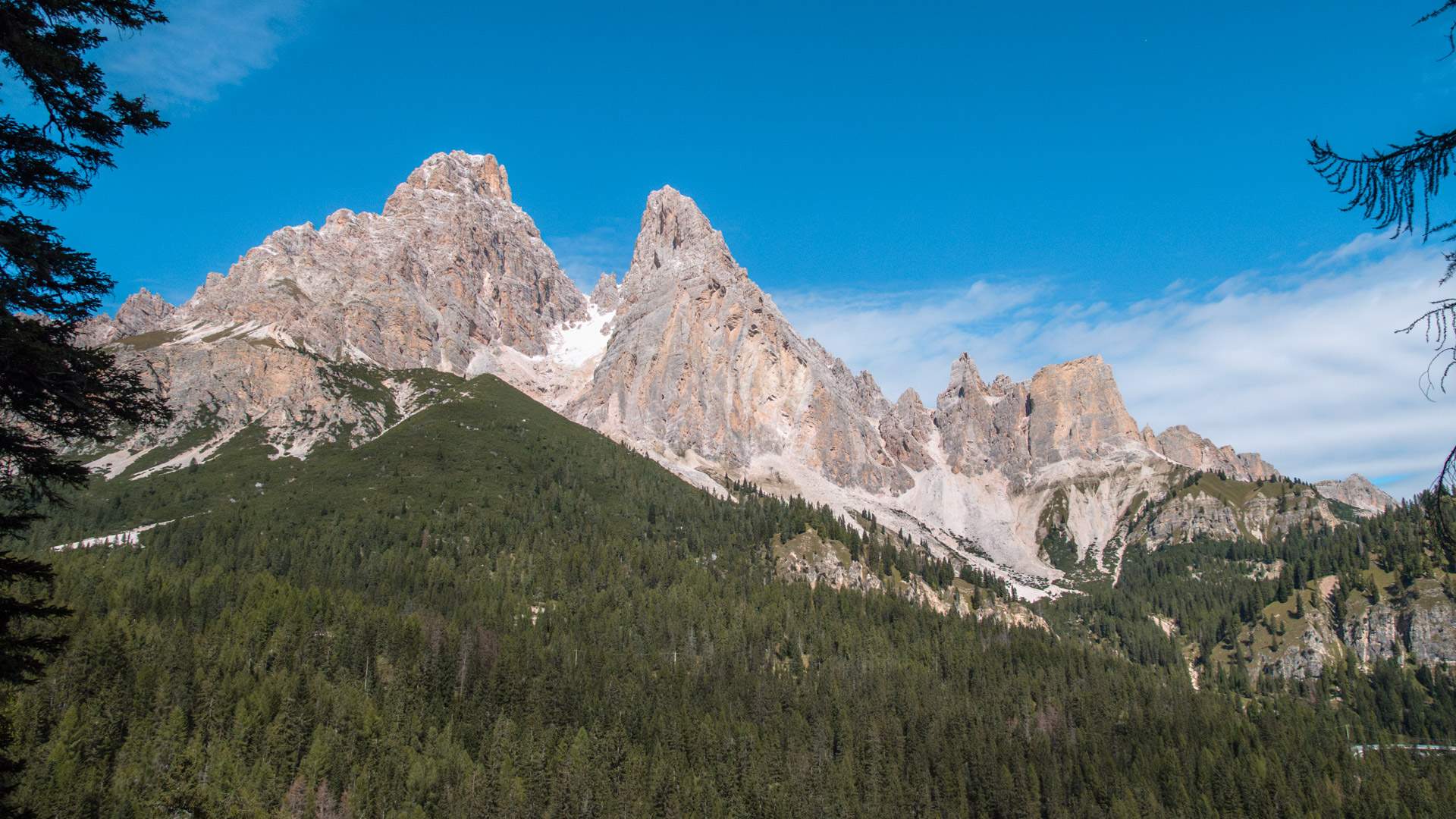
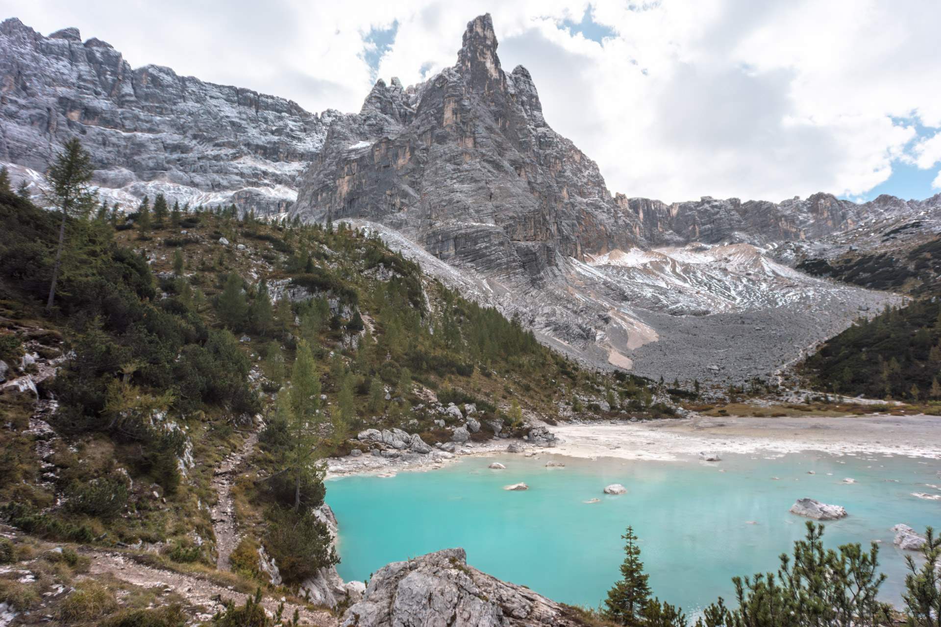
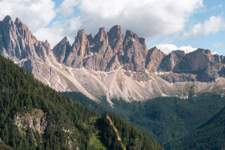
Throughout the walk, you’re rewarded with fantastic views of the surrounding peaks, including Monte Cristallo, Piz Popena, the sharply pointed Cadini di Misurina, and the Marmarole massif.
Travel guide to the dramatic viewpoint near Tre Cime di Lavaredo
Read moreWalk around Lago di Sorapis
If you fancy a bit more walking, you can do a full circuit around the lake.
It takes around 30 minutes, with the upper path being the easiest route.
You can also climb slightly up the slopes (just be careful to avoid stepping on the vegetation) or stand on some of the large stones by the water for great photo opportunities. Of course, please be mindful of other visitors.
The blue water looks almost unreal, but it really is that vibrant!
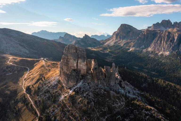
The dramatic peak often seen in photos of Lago di Sorapis is called Dito di Dio (Finger of God).
What to know before you go to Lago di Braies – including parking, the lake walk and our best tips
Read moreKnow the route in advance with Google Street View
A fellow hiker has kindly captured 360-degree photos of the entire route (including the walk around the lake), so you can explore it on Google Street View before you go.
For instance, you can check out one of the trickier spots on the trail here:
Make the hike a loop
There are two ways to return to the starting point.
You can either retrace your steps along route 215, or take an alternative path over the Forcella Marcoira Pass, turning the hike into a loop.
This option is much more demanding, but you’ll also encounter far fewer hikers along the way.
The loop adds about a kilometre to the distance (~ 0.62 miles), so instead of a two-hour return walk, you should allow around three hours – depending on your fitness level and how often you stop for breaks or photos.
If you choose the loop, you’ll face approximately 900 metres of total ascent and descent (~ 2,950 feet).
There are some steep and rocky sections on the descent, so this route is best suited for experienced hikers and only in good weather. In summer, you might even still find patches of snow on the trail.
We’ll describe it below.
Route 216 and 213
If you want to take the alternative route back, leave the lake following the same path you took outbound (route 215). After about 10 minutes’ walk, turn left onto path 216.
This is the same spot where you previously turned left to head towards the lake.
From here, the climb gets noticeably steeper, and over the next hour you’ll ascend a few hundred metres.
The trail surface varies between large stones and loose gravel, and in some places you’ll need to use your hands to scramble.
At Forcella Marcoira pass, be careful not to take path 223 – stay on path 216 instead.
Further along, take the right fork onto path 213, which leads back to Passo Tre Croci.
We didn’t do the loop ourselves, but if you’re up for a bigger challenge and well prepared, the views are said to be worth the effort.
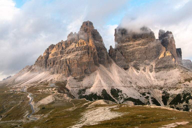
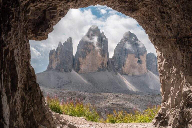
From the top of the pass, you can enjoy sights including the iconic Tre Cime di Lavaredo and Lago di Misurina.
Travel guide to one of the best hikes in the Dolomites – route, highlights, facilities and our top tips
Read moreOur experience at Lago di Sorapis
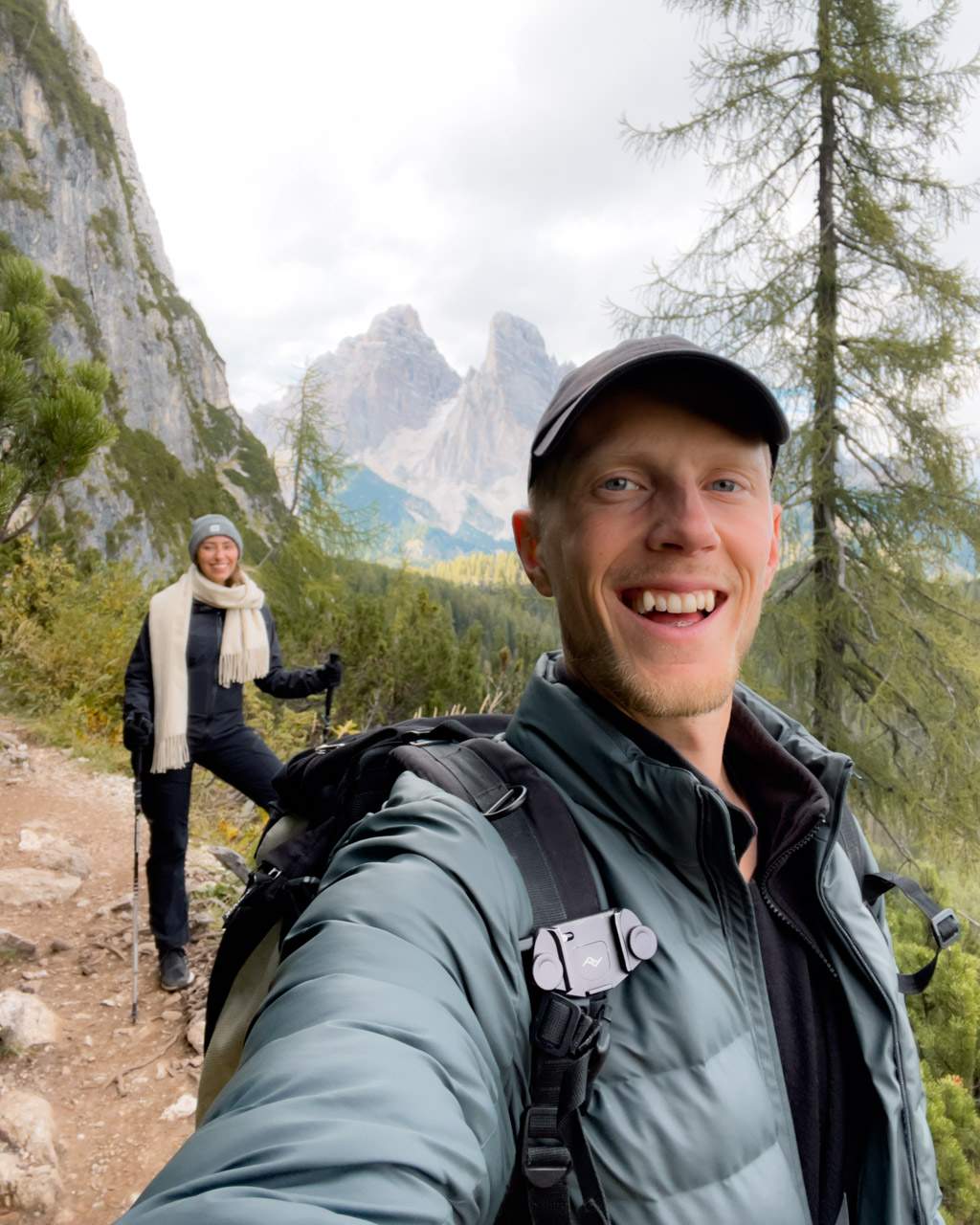
We visited Lago di Sorapis on an autumn trip to the Dolomites at the end of September.
Luckily, we found a parking spot right at the start of the hike, and we were well-prepared with suitable clothes, snacks and hiking poles for the moderately challenging hike.
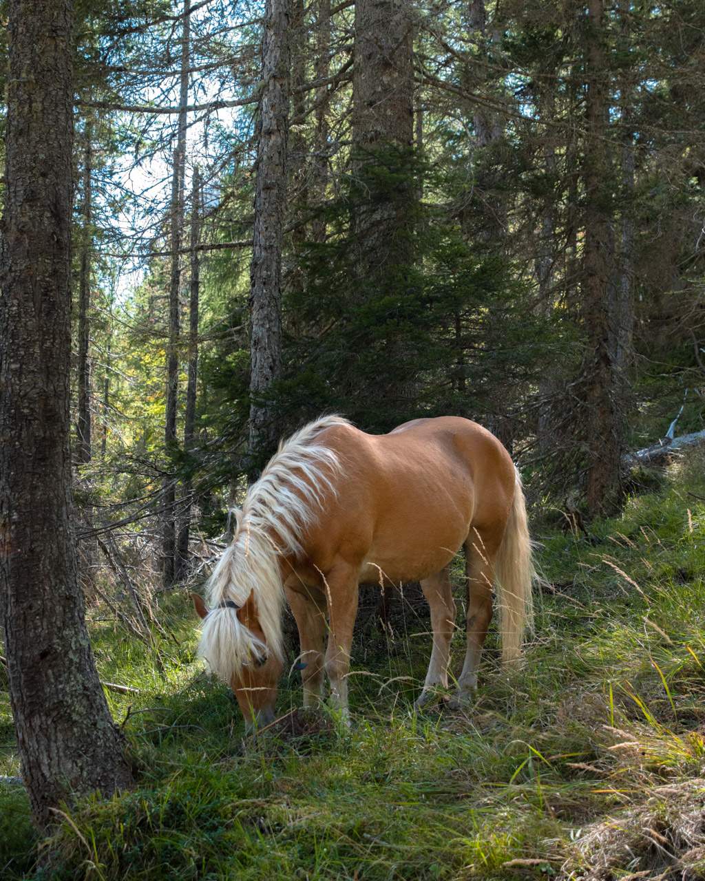
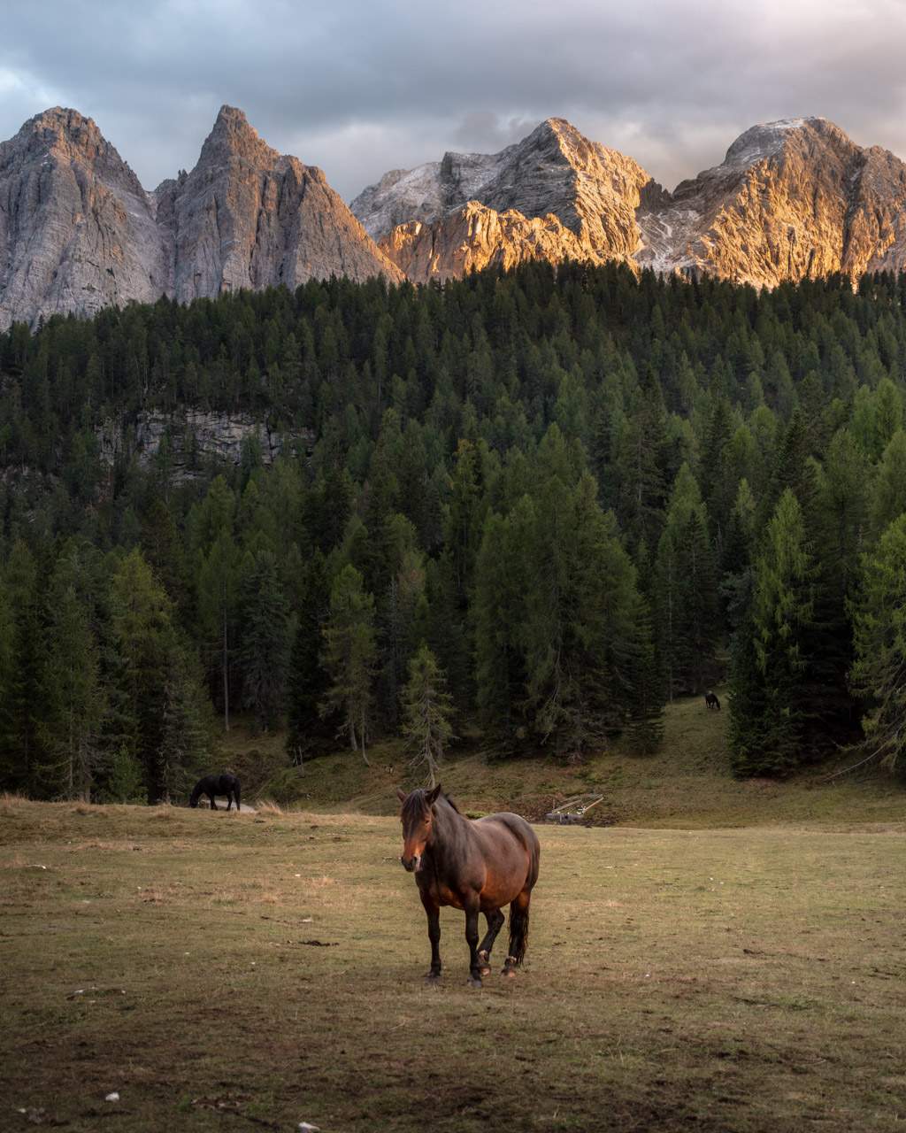
As we made our way through the pine forest, we came across some cute horses wandering among the trees – a perfect start!
Although the trail was at times a bit tougher than some other hikes we’ve done in the Dolomites, it never felt overwhelming.
Thankfully, the weather was kind to us, and arriving relatively late in the season meant the trail wasn’t crowded.
On the downside, the lake wasn’t as full as it is in spring or summer, but that didn’t bother us – the turquoise colour was still stunning!
Naturally, we took plenty of photos from every angle of this incredible natural wonder, and later stopped for a break at the refuge, which was still open.
For the return, we chose to retrace our steps, as it’s the “easiest” option. The views were just as impressive on the way back, and we left with wonderful memories.
Practical information about Lago di Sorapis
Opening hours
Lago di Sorapis has no official opening hours, so you can visit at any time.
That said, there may be snow on the trail from October to May.
We’d only recommend attempting the hike during these months if you have experience with snow and the proper equipment.
Personally, we wouldn’t feel comfortable tackling the narrow, exposed sections on slippery ground.
Note: Camping by the lake is not permitted.
Price
Visiting Lago di Sorapis is completely free!
Even parking is free of charge, which is quite unusual for popular spots in the Dolomites.
Restaurants
There are no food or drink options along the trail, but near the lake you’ll find Rifugio Vandelli.
The refuge is only open during the summer months, from late June to late September. You can have lunch here between 11:30 and 14:30. Don’t forget to bring cash!
Toilets
There’s a toilet at Rifugio Vandelli by the lake, which is open when the refuge is (typically from late June to late September).
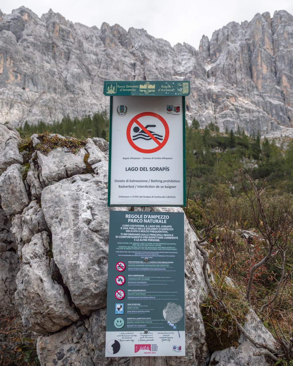
Can you swim in Lago di Sorapis?
Swimming in Lago di Sorapis is not allowed.
The lake’s delicate ecosystem (which helps create its distinctive turquoise colour) is very fragile.
With so many visitors, swimming would not be sustainable. Substances like sweat and sunscreen residue can harm the water quality.
There are also clear signs around the lake stating that swimming is prohibited.
Can you fly a drone at Lago di Sorapis?
Lago di Sorapis is not within the Parco Naturale Delle Dolomiti d’Ampezzo, so no special permit was required to fly a drone when we visited.
That said, it’s always wise to check the latest drone regulations for the area before you go.
There weren’t many people around when we were at Lago di Sorapis, but to avoid disturbing other visitors and preserve the peaceful atmosphere by the shore, we made sure to fly our drone well away from the lake and the refuge.
All you need to know about hiking to Lago di Coldai – parking, the route and our best tips
Read moreHow to get to Lago di Sorapis
You can reach Lago di Sorapis by starting the hike from Passo Tre Croci, which lies between Cortina d’Ampezzo and Misurina in the Dolomites.
Driving time from towns in the Dolomites
Driving times to Passo Tre Croci naturally depend on where you’re coming from – and can vary quite a bit, as the Dolomites cover large distances with winding mountain roads.
Here are some approximate times from nearby towns:
- Misurina: About 10 minutes’ drive from Passo Tre Croci. A small town near the picturesque Lago di Misurina.
- Cortina d’Ampezzo (Hayden): Around 15 minutes’ drive. One of the most popular towns in the Dolomites, well-located for visiting both Lago di Sorapis and Tre Cime.
- Dobbiaco (Toblach): Approximately 30 minutes’ drive, about 26 kilometres (~ 16 miles) away. Another town relatively close to Passo Tre Croci and well-positioned for Lago di Braies.
- Auronzo: Around 30 minutes’ drive, about 25 kilometres (~ 15.5 miles) southeast of Passo Tre Croci. Slightly less touristy and more affordable than Cortina, it’s a good base for excursions to Tre Cime, Lago di Misurina and Lago di Sorapis.
- Brunico (Bruneck): About 1 hour’s drive, roughly 50 kilometres (~ 31 miles) away. One of the larger towns in the area.
Parking
Lago di Sorapis parking is free!
If you’re coming by car, the easiest place to park is on the side of the road along SR48, right at the start of the walking route.
There are only a few spaces there, though, so if you arrive at a busy time, you can park at the parking lot at Passo Tre Croci instead, which is about 500 metres (~ 0.31 miles) from the start of the trail.
All you need to know about hiking to Lago di Limides – route, parking and our best tips
Read morePublic transport
You can reach the start of the hiking route to Lago di Sorapis (at Passo Tre Croci) by public transport, but the options are somewhat limited.
From Cortina d’Ampezzo, you can take the local bus, Dolomiti Bus (lines 30 or 31) towards Misurina.
The bus stops at “Passo Tre Croci”, which lies about halfway between Cortina and Misurina and is close to the start of path 215 towards Lago di Sorapis. The bus journey takes roughly 15 minutes.
If you’re travelling from further away (such as Dobbiaco/Toblach, Misurina or Auronzo), you’ll usually need to take a bus to Cortina first and then catch the bus to Passo Tre Croci.
During summer, buses run fairly frequently, but outside the high season, services may be less regular, so it’s a good idea to check the timetables in advance.
You can plan your route and check the connections here.
Note: There are no ticket machines at the Passo Tre Croci stop, so you’ll need to buy your ticket beforehand or from the driver (cash only, as far as we know). If you have mobile data, you can also purchase tickets via the Dolomiti Bus App.
How to reach the alpine plateau of the Dolomites, hiking trails, best hotels, our top tips and more
Read moreWhen to visit Lago di Sorapis
When to visit Lago di Sorapis depends on how many people you want to share the experience with and what kind of weather you’re comfortable hiking in.
If you have the freedom to choose, we’d recommend late June, early July or late September.
At these times, the paths are usually clear of snow, the weather is pleasant, the refuge is open, and the trail isn’t overcrowded.
The route isn’t suitable for walking after rain, as it can become slippery.
We discuss the differences between seasons and times of day in more detail here.
Seasons
Spring (May to mid-June)
Spring arrives late in the mountains, so it’s important to check the weather forecast and trail conditions before you go.
In May, there may still be snow on the paths, and the lake can be partially frozen.
Hiking can be risky without the right equipment, so we’d recommend waiting until later in June to visit Lago di Sorapis, unless you have experience hiking in snow.
On the plus side, there are fewer visitors in spring, so if the weather is good, it can be a peaceful experience.
Bear in mind the refuge by the lake is closed during this time.
Summer (mid-June to August)
Summer is the prime season for exploring the Dolomites, and Lago di Sorapis is no exception.
The weather is usually pleasant, and the lake shows its famous turquoise blue, thanks to meltwater from the mountains.
As a result, July and August are the busiest months on the trails (and in the parking areas).
Autumn (September and October)
We visited Lago di Sorapis in late September and can recommend it if you want to avoid the largest crowds.
The landscape shifts to warm, golden autumn colours, the temperatures cool down, and the lake still retains its stunning colour, although water levels may be lower.
The refuge is generally open until mid or late September. In October, snow can fall if the weather gets very cold.
Winter (November to April)
In winter, the path is usually covered in snow, making access to Lago di Sorapis difficult and potentially dangerous without specialist equipment.
We wouldn’t feel safe crossing the narrow, exposed sections in snowy conditions.
The lake is often frozen and snow-covered, so you won’t see its characteristic turquoise colour.
For these reasons, winter is not the best time for hiking to Lago di Sorapis.
The refuge by the lake is closed from late September until late June.
Time of day
No matter what season you visit Lago di Sorapis, the busiest times are usually during the day.
If you want to avoid large crowds and have a better chance of finding parking near the start of the hiking route, the best time to set off is in the morning – ideally as early as possible.
You’ll also often get the best light for photos in the morning or later in the afternoon.
That said, the lake is beautiful all day long, and its striking blue water looks great both in person and in pictures at any time!
The most important thing is to check the weather forecast for the day you plan to hike.
Note that the sun sets earlier at Lago di Sorapis than “official” times suggest, as it dips behind the mountains before the actual sunset.
How long to spend at Lago di Sorapis
Taking the standard route to the lake and back usually takes roughly two hours each way.
Should you choose the loop instead, it’s wise to set aside about three hours for the return journey.
At Lago di Sorapis, most people spend between one and two hours, depending on how much you want to relax, take photos, have lunch or walk around the lake. A full circuit takes about half an hour.
You could take a short break just to enjoy the view, but it’s nicer to have plenty of time to fully appreciate this wonderful spot.
If you plan to eat lunch at Rifugio Vandelli, be sure to allow a little extra time.
Most visitors spend between five and seven hours in total visiting Lago di Sorapis.
All you need to know about visiting Seceda – how to get there by cable car and our best tips
Read moreWhere to stay near Lago di Sorapis
The towns in the Dolomites can be quite far apart, so if you want to avoid long drives to reach Lago di Sorapis, it’s important to choose your accommodation carefully.
B&B Hotel Passo Tre Croci Cortina (adlink) has the best location for hiking to Lago di Sorapis.
This three-star hotel sits right next to the trailhead and offers cosy, modern rooms. It’s also just 10 minutes from Lago di Misurina, 30 minutes from Tre Cime, and 40 minutes from Cinque Torri.
If you plan to explore more hikes and viewpoints in the area, it might be a good idea to pick a more central base or even switch accommodation along the way to be closer to different attractions.
Cortina d’Ampezzo (adlink) is the obvious choice for many, just 15 minutes from the start of the hike. It’s one of the liveliest and most popular towns in the Dolomites, well positioned for a variety of hikes and cable cars.
Below, we’ve listed a few other nearby towns worth considering.

Guide to visiting Cinque Torri – walking routes, cable car, parking and our best tips
Read moreBigger towns in the area
In addition to Cortina d’Ampezzo, the following towns are worth considering if you want to explore Lago di Sorapis and other Dolomite highlights:
- Misurina: A small town near the beautiful Lago di Misurina, just a 10-minute drive from Passo Tre Croci.
- Dobbiaco (Toblach): Not a particularly large town, but relatively close to Passo Tre Croci and Lago di Sorapis, with several hotels. It’s about 26 kilometres/16 miles away (around a 30-minute drive) and also near Lago di Braies.
- Auronzo: A little less touristy and more affordable than Cortina, Auronzo is still a good base for trips to Tre Cime, Lago di Misurina and Lago di Sorapis. It’s roughly 25 kilometres/15.5 miles (30 minutes’ drive) southeast of Passo Tre Croci.
- Brunico (Bruneck): One of the larger towns near Passo Tre Croci and Lago di Sorapis, located about 50 kilometres/31 miles away (approximately a one-hour drive).
Our recommendations for the best places to stay in the Dolomites, Italy
Read more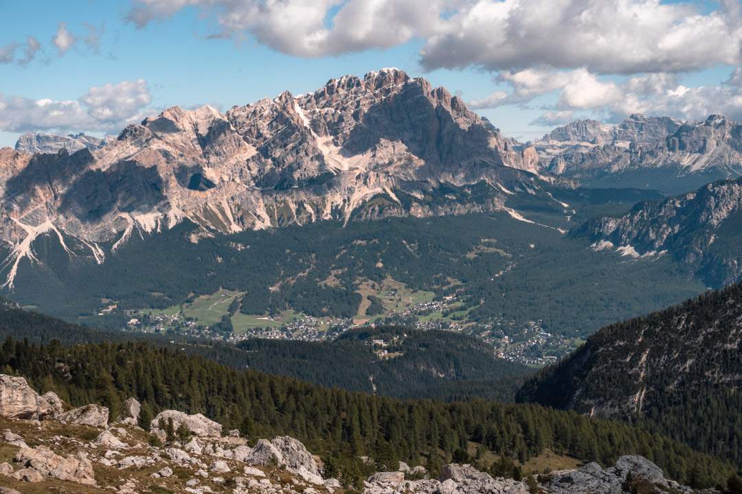
Hiking guide with everything you need to know about Monte Specie, including parking, route and our best tips
Read moreOur best tips for Lago di Sorapis
- Manage your expectations. Lago di Sorapis can get busy in high season and on weekends, so you won’t have the place to yourself.
- Be considerate of other hikers. Some parts of the path are narrow, and along the exposed cliff sections it’s safest to walk one at a time.
- Arrive early or late in the day for a quieter hike, especially if you want to enjoy the lake without the crowds.
- The sun rises late and sets early. Because of the surrounding mountains, daylight hours feel shorter than the official times.
- Bring a good camera. Lago di Sorapis is beautiful! Here is a guide to the gear we use.
- Be prepared for changing weather. Conditions can shift quickly and be very unreliable in the mountains. It often rains in the afternoon, but you never know in the Dolomites, so always check the forecast before setting off.
- Dress in layers. The weather at altitude can change quickly, and it often feels colder than expected.
- Wear proper footwear. Hiking shoes or sturdy sneakers with a good grip make the hike more enjoyable.
- Walking poles can be useful to relieve your legs – especially if you already have a pair.
- Bring food, drinks and snacks and enjoy them with a nice view by the lake, if you don’t plan to eat at the refuge (during opening hours).
- Use sunscreen and bring sun protection. The sun can be intense in the summer, even if the air feels cool.
- Remember to bring cash if you want to buy something at the refuge.
Practical tips + helpful advice to plan your Dolomites trip and enjoy every moment
Read moreSustainable travel tips
To travel as sustainably as possible, we recommend the following:
- Bring your own drinking water in a refillable bottle.
- Avoid disposable plastics.
- Dispose of waste properly and don’t leave anything behind.
- Take only photos and leave only footprints. Avoid picking flowers or taking anything from nature with you.
- Stick to the marked paths.
- Show consideration towards other visitors.
- Respect the local wildlife.
- Don’t swim in Lago di Sorapis.
Thank you for reading along
Thank you for reading our guide to Lago di Sorapis. We hope it helped you get a better sense of the hike!
What are your thoughts on the turquoise lake in the Dolomites?
If you’ve already been, we’d love to hear your best tips and experiences.
And if you haven’t, feel free to ask us anything in the comments. We’re happy to help.
More from the Dolomites
We absolutely love the Dolomites. Here are all our guides to the stunning mountains in northeastern Italy, with our best tips for hiking, viewpoints, where to stay, transportation and more.
Overview:
Hiking guides:
Our favourite travel resources:
- Booking.com for hotels and apartments.
- Momondo for the best flight deals.
- AirHelp for flight delay compensation.
- GetYourGuide for great tours everywhere.
- Airalo for reliable eSIM.
- Discover Cars for transparent car hire.
- SafetyWing for travel insurance. We also like True Traveller. Compared here.

Where to Stay in the Dolomites with Children: Best Family Hotels & Areas
Our recommendations for the best family-friendly hotels and areas in the Dolomites, Italy
-
Where to Stay in the Dolomites: Best Hotels & Areas for Hiking and Skiing Holidays
Our recommendations for the best places to stay in the Dolomites, Italy
-
When to Visit the Dolomites? Weather, Seasons & Best Time to Go
When to travel to the Dolomites and what to expect – whether you're into skiing or hiking