

The island’s best adventure
Koh Ngai, a small island in Thailand’s Andaman Sea, is a place for doing very little, with most of your time spent right by the glittering sea (or in it).
The Koh Ngai Nature Trail is the exception.
A marked path crosses the island’s southern half from the main beach to Paradise Beach, then past two more beaches, and ends with 151 steps up to two viewpoints over deep blue water.
The hike is relatively short, it’s well signposted, and it has a bit of everything, including jungle, stairs, ropes, a river to wade and a beach bar along the way.
We stayed two nights on Koh Ngai in late January 2026, as a family of four on a longer Andaman island-hop. Alex walked the full trail one afternoon by himself.
In this guide, we share what the trail is like stop by stop, how long it takes, how hard it is and what to bring.
Where to stay on Koh Ngai:
- Budget: Koh Ngai Camping – Raised tents with small decks right on the main beach, the cheapest way to sleep by the water.
- Budget: Koh Ngai Resort – A big, older resort on its own cove by the pier, and one of the island’s more affordable hotels.
- Value for money: Mayalay Resort – Where we stayed. Green-certified cottages on the main beach, a short walk from the trailhead.
- Value for money: Koh Hai Fantasy Resort & Spa – The family pick, with a pool, a playground and good food at fair prices right on the beach.
- Luxury: Coco Cottage – Eco-chic cottages and a saltwater infinity pool at the quieter northern end of the beach.
- Luxury: Thanya Beach Resort – Polished teak bungalows and a pool at the southern end, right where the trail starts.
- Luxury: Koh Ngai Paradise Beach – Garden villas on the secluded Paradise Beach, on the far side of the island.
Search for the best hotels on Koh Ngai here.
Table of contents


What to expect on the Koh Ngai Nature Trail
The trail belongs to Mu Ko Lanta National Park, which Koh Ngai is part of, and the park has done a good job.
There are signposts with distances at the junctions, a map board at the start and information boards along the way.
It goes one way, from the main beach to the viewpoints. You walk back the same way.
Here’s an overview of the trail:
- Start and finish: Thanya Beach Resort (adlink) at the southern end of Koh Ngai’s main beach. The signposts at the trailhead say the viewpoint is 2.7 kilometres (~ 1.7 miles) away.
- Distance: The park board says 3 kilometres (~ 1.9 miles) one way. Alex’s watch logged 5.4 kilometres (~ 3.4 miles) for the round trip, including a short side quest.
- Elevation: About 180 metres (~ 590 feet) of climbing in total, and the trail never gets higher than about 45 metres. The watch counted it as 50 flights of stairs, which feels about right.
- Duration: The park says about 1.5 hours one way. Alex did the whole round trip in 1 hour 15 minutes, with 55 minutes of walking and the rest photo stops, but he was in a hurry to get back to the family. Most people should set aside around 3 hours, and more for a swim or a stop at the beach bar.
- Difficulty: Easy to moderate. The surface is the challenge, not the length. There’s a steep descent with ropes near the start, a knee-deep river mouth to wade and 151 steps at the end.
- Trail surface: A paved path and concrete stairs at the start, then dirt, roots and rock through the forest, sandy tracks and beach, a wooden boardwalk and wooden stairs.
- Shoes: Proper sneakers or similar help a lot. Flip-flops will likely be a struggle on the steep bit.
- Shade: Plenty in the forest, less on the beaches.
- Suitable for children: Older kids who like a scramble, yes. Not with a stroller, and the ropes and the river make it hard work with a toddler (more below).
- Facilities: A restaurant and a beach bar at Paradise Beach, a little over halfway.
- Cost: Alex didn’t pay anything to walk it. The park map does mark an entrance-fee point at the ranger station, so have some cash on you just in case.

All you need to know about visiting Koh Lanta National Park, including the nature trail, the lighthouse, the beach and our best tips
Read moreMap of the Koh Ngai Nature Trail
The map below is Alex’s actual GPS track from the walk, with the photos pinned where they were taken.
The trail goes from the main beach on the east coast to the viewpoints on the island’s southwestern tip.

Where does the Koh Ngai Nature Trail start?
The trailhead is at Thanya Beach Resort (adlink), the last resort at the southern end of the main beach.
Walk through the resort towards the hill behind it and look for the brown signposts.
They set out the whole route: the hornbill viewing point 400 metres in, Paradise Beach 1.8 kilometres (~ 1.1 miles), the ranger station 2.4 kilometres (~ 1.5 miles) and the viewpoint 2.7 kilometres (~ 1.7 miles).
From the resorts further up the beach, it’s a flat walk along the sand to get here. From Mayalay Resort (adlink), where we stayed, it’s about 400 metres, or five minutes on foot.
Just past the signposts, the path forks, and a second signpost points left for the trail.
A couple of warning signs are here too, with “Danger, slippery area” and a reminder about poisonous wildlife and keeping to the path.
Then comes the park’s map board, and you’re off.


The route to Paradise Beach and the viewpoints, stop by stop
Up and over the ridge
The trail begins as a paved path climbing steeply out of the resort, with jungle on both sides and a view back over the bungalow roofs to the sea.
Then come concrete stairs with a rope strung alongside.
The first 200 metres take you from the beach to the top of the ridge.
A sign along the way identifies the mountain serdang palm, and the map board marks epiphytes further on.

Everything you need to know, including what to do, when to visit and how to get there
Read moreThe steep bit
The descent on the far side of the ridge is the part the signs politely undersell.
Call it “the steep bit”. It’s a rough slope of rock, roots and loose earth, with ropes along part of it to hold on to.
It drops about 35 metres in a couple of hundred metres.
It’s not as bad as it sounds, but it’s not nothing either, especially on the way back up. After rain, we can easily believe it gets slippery.

Ao Muang and the walk to Paradise Beach
At the bottom of that steep part, the trail levels out and forks towards two beaches.
A signpost gives Ao Muang, a small cove on its own spur, as 200 metres to the left, and Paradise Beach as 1.3 kilometres (~ 0.8 miles) straight on.
On the way back, Alex took the 200-metre side path down to Ao Muang, a narrow strip of sand under the trees with nobody on it.
This is also roughly where the trailhead sign puts the hornbill viewing point, 400 metres in. So the “short walk to the hornbills” still includes the steep bit, both ways.
Keep an eye on the canopy for the Oriental pied hornbill, which is listed on the park’s map board.
From here on until Paradise Beach, the walking is easy.
The path is sandy and flat, winding through forest and then under tall coconut palms as the trees open up towards the coast.
Another signpost at a low concrete building marks 600 metres to go, and soon you’re among the bungalows of the resort Koh Ngai Paradise Beach (adlink).
A hand-painted sign on a palm trunk warns of falling coconuts.


Paradise Beach
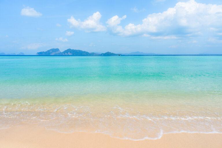
Paradise Beach is long and beautiful, with pale sand, calm turquoise water and a forested headland at the far end.
The resort, Koh Ngai Paradise Beach (adlink), has a restaurant and bar, and around the middle of the beach there’s a driftwood beach bar under a big tree, with handwritten menu boards and a few tables on the sand.
Judging by the longtails pulled up on the sand, the beach gets some traffic from the boat tours during the day.
It’s also one of the island’s most talked-about snorkelling spots, though a sign on the beach warns of jellyfish and sea urchins.
The signpost on the sand gives new distances. The viewpoint is 1 kilometre (~ 0.6 miles) away.
Either walk along the beach or the path just behind it to continue.


Our recommendations for the best places to stay from budget to luxury
Read moreThe river crossing
To continue, you wade across a small river mouth where the beach ends against the rocks.
At high tide, the water reached just above Alex’s knees, with no current to speak of. Expect wet legs, and consider carrying your shoes across.
On the other side, stone steps climb away from a tiny rocky cove, and a signpost at the top gives the next stops: ranger station 230 metres, Nui Beach 468 metres, Coconut Beach 500 metres.
The views from this stretch are some of the best on the walk, back across the bay to Paradise Beach, with longtails on the water and islands on the horizon.


The ranger station, Nui Beach and Coconut Beach
The forest path continues along the coast to the national park’s ranger station, marked by a wooden gate carved with “Koh Ngai Nature Trail” and a big illustrated map of the island.
The map shows a campsite here.
The board at the gate puts the last stretch, past Nui Beach and Coconut Beach up to the viewpoint, at 492 metres and about 30 minutes. It took Alex about eight.
Next up is little Nui Beach (Ao Nui), reached by a wooden boardwalk with railings and a bench.
An information board describes the beach ecosystem, and another one, titled “12 poisonous sea creatures”, explains why you should watch where you put your feet.
The boardwalk curves along the rocks, and a minute later you’re on a second small beach, which the park map calls Coconut Beach.


151 steps to the viewpoints
The finale is a long wooden staircase climbing straight up through the trees from the end of the beach. Alex counted exactly 151 steps.
At the top, a wooden deck hangs over the rocks, almost 40 metres above the sea.
The water below is deep blue, clear enough to see the rocks on the bottom, and on a good day you’ll see longtails and speedboats drawing white lines across it.
A board on the deck tells you about Koh Rok, the two islands you’re looking towards, famous for their coral and snorkelling. Day trips go there from Koh Ngai and Koh Lanta.
A path continues a little further along the hillside to a second viewpoint.


Everything you need to know about Koh Lanta, including the best beaches, what to do and our tips from two visits
Read moreThe way back
There’s no loop, so you go back the way you came.
Down the steps, along the boardwalk, through the river, along Paradise Beach, up the steep bit and back down to Ngai’s main beach.
Alex’s return took about half an hour, with fewer photo stops.


How hard is the Koh Ngai Nature Trail?
The trail is not very difficult if you’re reasonably fit and wearing the right shoes.
The distance is short, the climbing is modest and the signposting is good.
What makes it more than a stroll is the terrain. The steep bit likely needs hands as well as feet, and the river wade needs a bit of nerve.
Also, the 151 steps come at the end when it’s hot. And then you still need to do it all in reverse.
Alex walked it in the mid-afternoon heat in late January, and the forest keeps most of the sun off, but a morning start is still better.

Koh Ngai Nature Trail with kids
We didn’t take ours. Alex enjoys this kind of thing and is much faster on his own, Victoria and her mother weren’t itching to go, and with Adrian at 2.5 years old insisting on walking everywhere, the steep bit and all the stairs wouldn’t have been much fun.
With a baby in a carrier and a free hand for the ropes, it’s doable for a confident adult.
With school-age kids who like climbing, it’s a great little adventure, and the beach bar at Paradise Beach is a natural turnaround point if the full route is too much.
Everything we know about travelling in Thailand with a baby – including safety, packing, flights and where to stay
Read moreWhat to bring on the Koh Ngai hike
- Water. There’s nothing to buy until Paradise Beach, and nothing after it.
- Sneakers or similar with some grip. You may want to carry them through the river.
- Mosquito repellent for the forest stretches.
- Sunscreen and a hat for the beaches and the viewpoint.
- Swimwear. You pass four beaches, and the river crossing gets you half wet anyway.
- Some cash for the beach bar, and in case the ranger station is collecting the park fee.
- A dry bag or a plastic bag can be helpful for your phone and camera at the river.
Tips for hiking the Koh Ngai Nature Trail
- Start early. The forest is shaded, but the beaches and the stairs are not, and the afternoon heat makes it all harder than it needs to be.
- Time the river crossing with the tide if you’d rather keep your shorts dry. At high tide it was just above the knee when Alex went.
- Keep to the path. The park’s signs warn of poisonous wildlife, and the trail is easy to follow.
- Watch your feet in the water. Signs at Paradise Beach and Nui Beach warn of jellyfish and sea urchins around the rocks.
- Don’t stand under the coconut palms for longer than you have to.
- Short version: Thanya to Paradise Beach and back makes a shorter outing with the beach bar as the reward, though you still get the steep bit twice.
- Bring a good camera. Here’s our guide to lightweight photography gear for high-quality travel content.
- Don’t forget travel insurance. The nearest hospital is a boat ride away. We compare the best travel insurance for digital nomads and long-term travellers here.
- Pick up an eSIM. Mobile data is handy on an island where wifi can be hit and miss. We’ve previously used Airalo (adlink) with great success.
Make sure to read our full travel guide to Koh Ngai for more on the beach, the boats, the food and everything else about the island.

Essential Thailand travel tips covering costs, local customs, transport, safety and more.
Read moreSustainable travel tips
The trail is in a national park on a small island with fragile reefs. A few easy ways to tread lightly:
- Bring a refillable water bottle and fill it up at your resort.
- Take all your rubbish back with you. There are no bins on the trail.
- Stay on the marked path and leave the plants, shells and animals where they are.
- Don’t feed the wildlife, hornbills included.
- Use reef-safe sunscreen if you plan to swim.
Everything you need to know, including what to do, when to visit and how to get there
Read moreFAQ about the Koh Ngai Nature Trail
How long does the Koh Ngai Nature Trail take?
The national park gives about 1.5 hours each way for the 3 kilometres (~ 1.9 miles) out to the viewpoint. Alex was walking alone and in a hurry, and he was back at the start after 1 hour 15 minutes, 55 of them on the move.
At a normal pace, plan for about 3 hours there and back. Add time for a swim or a stop at the beach bar.
How far is Paradise Beach from the main beach on Koh Ngai?
The signposts at Thanya Beach Resort (adlink) say 1.8 kilometres (~ 1.1 miles), which is a little over halfway along the trail. You go over a ridge and down a rocky, roped slope that drops about 35 metres, and from there the walking is easy.
If you only want Paradise Beach, walking there and back makes a good shorter outing, with the beach bar as the place to turn around. You still do the steep part in both directions, though.
Do you have to pay to hike the Koh Ngai Nature Trail?
Nobody asked Alex for money anywhere on the trail.
The park’s own map shows a point at the ranger station where an entrance fee can be collected, so bring a little cash in case someone is there. You’ll want cash for the beach bar at Paradise Beach anyway.
Can you swim and snorkel along the Koh Ngai Nature Trail?
Yes. The route passes four beaches, so bring swimwear.
Paradise Beach is one of the snorkelling spots people talk about most on the island, and the water at little Nui Beach is clear.
Signs at both beaches warn of jellyfish and sea urchins around the rocks, so watch where you step. Use reef-safe sunscreen if you go in.
When is the best time to hike the Koh Ngai Nature Trail?
Alex walked it in late January, at the height of the dry season, and the trail wasn’t slippery. After heavy rain, expect the roped descent near the start to be.
Go in the morning if you can. The forest gives shade, but the beaches and the 151 steps are in full sun in the afternoon.
If you’d rather keep your shorts dry, check the tide before you set off. At high tide the river mouth came just above Alex’s knees.
Can you watch the sunset from the Koh Ngai viewpoint?
Yes. The viewpoints are at the end of the trail on the island’s southwestern tip, and you can see west clearly from them.
Walking back after sunset is doable, but you need sure footing and good light, which means a strong torch or a headlamp. The way back includes the 151 steps, the river crossing and the steep, roped slope, and the jungle at night is a different place from the jungle by day.
It’s most practical if you’re staying at Paradise Beach. The beach is a little over halfway along the trail, so the walk home in the dark is much shorter.
Thanks for reading our Koh Ngai Nature Trail guide
We hope it helps you plan your hike on Koh Ngai.
For the rest of the island, including where to stay, what to eat and how to get there, have a look at our Koh Ngai travel guide and our guide to where to stay on Koh Ngai.
Have you walked the trail? Let us know how the river crossing went in the comments below.
Enjoy Koh Ngai!
Our favourite travel resources:
- Booking.com for hotels and apartments.
- Momondo for the best flight deals.
- AirHelp for flight delay compensation.
- GetYourGuide for great tours everywhere.
- Airalo for reliable eSIM.
- Discover Cars for transparent car hire.
- SafetyWing for travel insurance. We also like True Traveller. Compared here.

Where to Stay on Koh Ngai: The Best Hotels in All Price Ranges
Our recommendations for the best places to stay from budget to luxury
-
Koh Ngai Travel Guide: 7 Best Things to Do
Everything you need to know, including what to do, when to visit and how to get there
-
Koh Lanta National Park: How to Visit & What to Expect
All you need to know about visiting Koh Lanta National Park, including the nature trail, the lighthouse, the beach and our best tips


